Musconetcong Mountain

Musconetcong Mountain
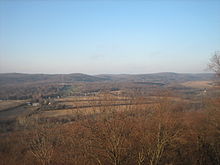
The view from Point Mountain of Anderson and the Musconetcong Valley

Musconetcong Mountain is a ridge in the Highlands region of New Jersey running south of and parallel to the Musconetcong River. The ridge travels through Alexandria, Holland, Bethlehem and Lebanon Township[1].

Contents

Prominent Features

  • Point Mountain, 935 feet, in Lebanon Township

Central Delaware Valley American Viticultural Area

The southern boundary of the Central Delaware Valley AVA, an American Viticultural Area, is near Titusville, New Jersey, and its northern border is near Musconetcong Mountain.

References

Links

Coordinates: 40°39′29″N 75°00′34″W / 40.658113°N 75.009413°W / 40.658113; -75.009413


Wikimedia Foundation. 2010.

Игры ⚽ Нужно сделать НИР?

Look at other dictionaries:

  • Musconetcong — may refer to the following in the U.S. state of New Jersey: Musconetcong Mountain, a ridge in the Highlands region Musconetcong River, a tributary of the Delaware River Lake Musconetcong, in Sussex County This disambiguation page lists articles… …   Wikipedia

  • Musconetcong River — A view looking down the Musconetcong River between Warren and Morris Counties. The Musconetcong River is a 45.7 mile long (73.5 km)[1] tributary of the Delaware River in northwestern New Jersey in the United States. It flows through the… …   Wikipedia

  • Schooley's Mountain — Infobox Mountain Name = Schooley s Mountain Photo = schooleys1.jpg Caption = Schooley s Mountain near Long Valley, NJ Elevation = 1,120 feet (507 meters) Location = New Jersey, USA Range = Prominence = Coordinates =… …   Wikipedia

  • Allamuchy Mountain State Park — is well known as having some of the best trout fishing in the state. Located in Byram Township, New Jersey, USA, the park offers a variety of activities all year round. The park is operated and maintained by the New Jersey Division of Parks and… …   Wikipedia

  • Pohatcong Mountain — is a ridge, approximately 6 mi (10 km) long, in the Appalachian Mountains of northwestern New Jersey in the United States. It extends from west Phillipsburg northeast approximately to Washington. The ridge continues north of Washington as Upper… …   Wikipedia

  • County Route 519 (New Jersey) — County Route 519 Route information Length: 88.54 mi[1] (142.49 km) …   Wikipedia

  • County Route 579 (New Jersey) — County Route 579 Route information Length: 37.24 mi[1] (59.93 km) …   Wikipedia

  • New York-New Jersey Highlands — The New York New Jersey Highlands is a geological formation composed primarily of precambrian igneous and metamorphic rock running from the Delaware River near Musconetcong Mountain, northeast through the Skylands Region of New Jersey along the… …   Wikipedia

  • Geography of New Jersey — Location of New Jersey in the world Location of New Jersey in the U.S.A …   Wikipedia

  • Geology of New Jersey — The Geology of New Jersey consists of four distinct physiographic provinces. They are: (listed from the south to the north) the Atlantic Coastal Plain Province, the Piedmont Province, the Highlands Province, and the Ridge and Valley… …   Wikipedia

Share the article and excerpts

Direct link
Do a right-click on the link above
and select “Copy Link”