Mupe Bay

Mupe Bay
Mupe Bay

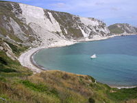
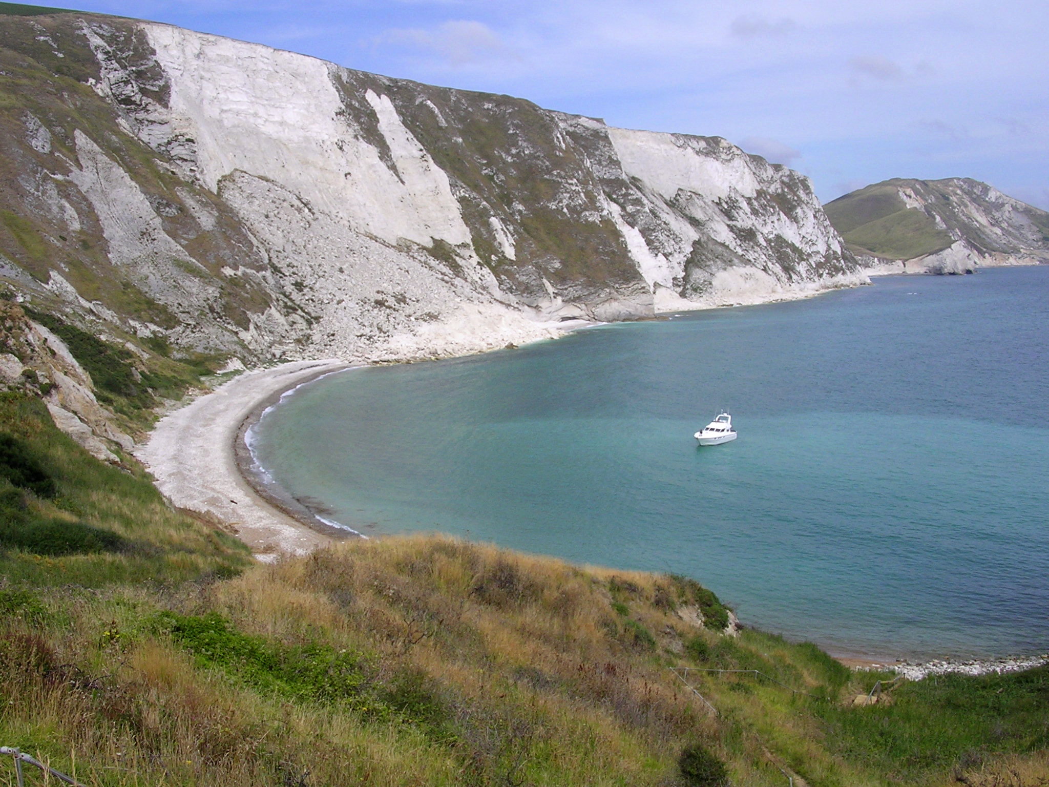
Mupe Bay is a bay with shingle beach to the east of Lulworth Cove in Dorset, England, and is part of the Jurassic Coast World Heritage Site.

It exposes a sequence of Cretaceous rocks from the Bindon Hill Chalk in the north through the Wealden Beds to the Purbeck Beds in the south at Mupe Rocks.

Mupe Bay is only accessible when the Lulworth Military Ranges are open to the public. It can be reached by a 2.5-kilometre (1.6 mi) walk from the car park at Lulworth Cove.

To the south are Mupe Ledges and out to sea Mupe Rocks.

See also

External links

Coordinates: 50°37′7″N 2°13′21″W / 50.61861°N 2.2225°W / 50.61861; -2.2225


Wikimedia Foundation. 2010.

Игры ⚽ Поможем сделать НИР

Look at other dictionaries:

  • Worbarrow Bay — Gewässer Ärmelkanal Landmasse …   Deutsch Wikipedia

  • Liste der Orte entlang der Jurassic Coast — Die Geoneedle am Orcombe Point nahe Exmouth besteht aus verschiedenen Gesteinsarten, die entlang der Jurassic Coast zu finden sind. Eine Liste der Orte entlang der Jurassic Coast an der Südküste Englands, von Devon bis in die Grafschaft Dorset… …   Deutsch Wikipedia

  • Cow Corner — Dieser Artikel wurde wegen inhaltlicher Mängel auf der Qualitätssicherungsseite des Portals Geowissenschaften eingetragen. Dies geschieht, um die Qualität der Artikel im Themengebiet Geowissenschaften zu steigern. Bitte hilf mit, die Mängel zu… …   Deutsch Wikipedia

  • Isle of Purbeck — Fishermans ledge in Purbeck Gewässer Ärmelkanal …   Deutsch Wikipedia

  • List of bays of the British Isles — This is a list of bays of the British Isles, geographically by island. They are listed by island, in clockwise order, from the stated starting point.BritainClockwise from the River Tweed:England from the River Tweed to the Bristol Channel*Budle… …   Wikipedia

  • List of Dorset beaches — There are many beaches in Dorset, southern England, with most of them making up the UNESCO World Heritage Site, The Jurassic Coast. Here is a list of most of them, from west to east:*Lyme Regis *Charmouth *West Bay *Chesil Beach *Chesil Cove… …   Wikipedia

  • Bindon Hill — Location map|Dorset label = lat = 50.62 long = 2.23 caption = Map showing the location of Bindon Hill within Dorset. float = right background = white width = 200Bindon Hill is an extensive Iron Age earthwork enclosing a coastal area near Lulworth …   Wikipedia

  • Cow Corner — Looking down to Worbarrow Bay and Cow Corner to the very left is Arish Mell Known as Cow Corner is the north western end of Worbarrow Bay, a small secluded bay on the south coast of the Isle of Purbeck, in Dorset England …   Wikipedia

Share the article and excerpts

Direct link
Do a right-click on the link above
and select “Copy Link”