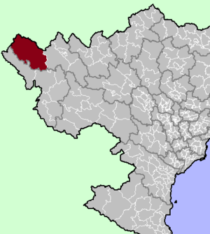
- Muong Te District
-
Mường Tè District — District — District location in northern Vietnam Country  Vietnam
Region Northwest Province Lai Chau Province Capital Muong Te Area - Total 1,420.5 sq mi (3,679 km2) Population (2003) - Total 47,406 Time zone UTC + 7 (UTC+7) Muong Te (Vietnamese: Mường Tè) is a district (huyện) of Lai Chau Province in the Northwest region of Vietnam.
As of 2003 the district had a population of 47,406.[1] The district covers an area of 3,679 km². The district capital lies at Muong Te.[1]
Geography
The district lies in the western part of Lai Chau Province, to the west of Sin Ho District.[2]
Nậm Hàng commune in Mường Tè district is the site of the Lai Châu Dam, currently under construction.[3][4]
References
- ^ a b "Districts of Vietnam". Statoids. http://www.statoids.com/yvn.html. Retrieved March 13, 2009.
- ^ Vietnam Bike Tours. Lai Chau Travel Map (Map). http://www.vietnambiketours.asia/wp-content/uploads/2011/04/LaiChau.jpg.
- ^ The Saigon Times: Hai vấn đề nóng của thủy điện Lai Châu
- ^ "Work on Vietnam's third largest hydropower plant begins". Thanh Nien. Intellasia News Services. 2011-01-14. http://www.intellasia.net/news/articles/infra_resources/111313560.shtml. Retrieved 2011-01-22.
Coordinates: 22°19′59″N 103°34′59″E / 22.333°N 103.583°E
 Districts of Northwest Vietnam (Tay Bac)
Dien Bien province Dien Bien Phu · Muong Lay · Dien Bien · Dien Bien Dong · Muong Cha · Muong Nhe · Tua Chua · Tuan Giao
Lai Chau province Son La province Hoa Binh province Categories:- Districts of Lai Chau Province
- Northwest Vietnam geography stubs
Wikimedia Foundation. 2010.

