- Armería Municipality
-
Armería — Municipality — Río Armería 
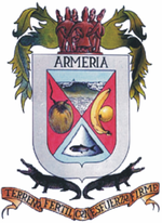
Coat of armsMotto: La tierra fertil con el esfuerzo firme Municipality of Armería in Colima Country  Mexico
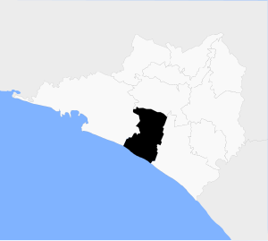
State Colima Municipal seat Ciudad de Armería Largest city Ciudad de Armería Municipality created 1967 Government – Municipal president Juan Manuel Covarrubias Leyva Area – Total 341.6 km2 (131.9 sq mi) Population (2005) – Total 24,939 – Density 73/km2 (189.1/sq mi) Data source: INEGI Time zone CST (UTC-6) – Summer (DST) CDT (UTC-5) INEGI code 001 Website (Spanish) Ayuntamiento de Armería Source: Enciclopedia de los Municipios de México Armería is a municipality in the south-central part of the Mexican state of Colima. The municipality reported 24,939 inhabitants in the 2005 census and has an area of 341.6 km² (131.89 sq mi). Its municipal seat is Ciudad de Armería; with a 2005 census population of 14,091, this is the fifth-largest community in the state in population.[1][2]
References
- ^ "Link to tables of population data from Census of 2005" (in Spanish). Instituto Nacional de Estadística, Geografía e Informática ( INEGI). http://www.inegi.gob.mx/est/contenidos/espanol/sistemas/conteo2005/localidad/iter/. Retrieved 2007-12-28.
- ^ "Armería" (in Spanish). Enciclopedia de los Municipios de México. INAFED. http://www.e-local.gob.mx/work/templates/enciclo/Colima/Mpios/06001a.htm. Retrieved 2007-12-28.
External links
- (Spanish) H. Ayuntamiento de Armería, Col. municipal government web site.
- (Spanish) Armería in the Enciclopedia de los Municipios de México.
Coordinates: 18°56′10″N 103°57′54″W / 18.936°N 103.965°W
Municipalities
and
(municipal seats)Armería (Ciudad de Armería) · Colima (Colima) · Cuauhtémoc (Cuauhtémoc) · Manzanillo (Manzanillo) · Minatitlán (Minatitlán) · Comala (Comala) · Coquimatlán (Coquimatlán) · Ixtlahuacán (Ixtlahuacán) · Tecomán (Tecomán) · Villa de Álvarez (Villa de Álvarez)
 Categories:
- Municipalities of Colima
- Mexico geography stubs
Wikimedia Foundation. 2010.


