- Munhata
-
Munhata 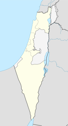
 Shown within Israel
Alternate name Horvat Minha, Khirbet Munhata Location Israel Coordinates 32°39′09″N 35°27′47″E / 32.652383°N 35.463181°E Type Tell History Founded ca. 8300 BC Abandoned ca. 6000 BC Cultures PPNB, Neolithic, Chalcolithic Site notes Excavation dates 1962-1963 Archaeologists Jean Perrot Public access yes Munhata (Horvat Minha or Khirbet Munhata) is an archaeological site 11 kilometres (6.8 mi) south of Lake Tiberius, Israel on the north bank and near the outlet of Nahal Tavor on a terrace 215 metres (705 ft) below sea level.[1]
Contents
Excavations
The area of 2,000 square metres (22,000 sq ft) in the Jordan Valley was first excavated in 1962 by Jean Perrot. The deposits on site were 3 metres (9.8 ft) deep and divided up into six distinct layers of occupation. These have been divided into PPNB aceramic during levels six to three, with later neolithic and chalcolithic, Yarmukian and Wadi Rabah culltures in levels two and one.
Construction
Buildings in the earlier stages had stone, paved or plastered floors made of mud bricks on stone foundations with remains of hearths and other stone structures. The north walls of buildings contained a plastered niche, a feature found in a similar room in Jericho.[2] The PPNB levels also revealed an unusual circular courtyard structure with rooms radiating out from it and a large platform with channels cut in it associated with a pebble lined trough, presumably used for craft purposes.[3] The Yarmoukian phase continued with round buildings which developed into rectangular ones in the Rabah phase.[2] A major break in settlement was detected between levels three and two, where the early levels were covered over with sandy soil.
Culture
Various flint tools and arrowheads were recovered from the site. Arrowheads had distinctive tangs (some barbed) with wings and pointed shoulders, some were diamond or leaf shaped and a few were notched. Finely denticulated sickle blades were found in large numbers with other tools including end scrapers, blades, burins and borers. One piece of obsidian was found in level six that originated from the same place as a piece from El Khiam. Grinding tools were also found including pestle and mortars of basalt or limestone, polishers, rubbers and grooved stones. Stoneware vessels were found along with a few greenstone beads.[2] The site was also notable for finds of clay figurines of males, females and animals.
Dating
Radio-carbon dating of the site had large stated errors due to problematic dating materials but gave dates between ca. 7210 and 5420 BC. These provide a vague suggestion of the age of the site. Typological comparisons have been made of various artifacts highlighting a certain regional variation with more elaborate design arrowheads and less pressure flaking. This equates generally with the PPNB stages of Jericho and Beidha suggesting that occupations overlapped with these sites and a date of occupation during the middle and late 7th millennium BC.[2]
Further Reading
- Jean Perrot (1964). Les deux premières campagnes de fouilles a Munhatta, 1962-1963: premiers résultats. Librairie Orientale P. Geuthner. http://books.google.com/books?id=1S05HQAACAAJ. Retrieved 25 April 2011.
- Perrot, Jean., La troisieme campagne de fouilles a Munhata (1964), Syria 43, 1966.
- Yosef Garfinkel; Yuval Goren; Centre de recherche français de Jérusalem; France. Direction générale des relations culturelles, scientifiques et techniques (1992). The pottery assemblages of the Sha'ar Hagolan and Rabah stages of Munhata. Publié avec le concours de la DGRCST. http://books.google.com/books?id=IjwpOgAACAAJ. Retrieved 25 April 2011.
- Yosef Garfinkel (1995). Human and animal figurines of Munhata. Association Paléorient. http://books.google.com/books?id=2APjAAAAMAAJ. Retrieved 25 April 2011.
- Avi Gopher (1989). The flint assemblages of Munhata: final report. Association Paléorient. http://books.google.com/books?id=qsH0OQAACAAJ. Retrieved 25 April 2011.
References
- ^ Eric M. Meyers; American Schools of Oriental Research (1997). The Oxford encyclopedia of archaeology in the Near East. Oxford University Press. http://books.google.com/books?id=KYzrAAAAMAAJ. Retrieved 25 April 2011.
- ^ a b c d Moore, A.M.T. (1978). The Neolithic of the Levant. Oxford University, Unpublished Ph.D. Thesis. pp. 176–178. http://ancientneareast.tripod.com/109.html.
- ^ Peter Neal Peregrine; Melvin Ember; Human Relations Area Files; inc (2002). Encyclopedia of Prehistory: South and Southwest Asia. Springer. pp. 52–. ISBN 9780306462627. http://books.google.com/books?id=C-TQpUtI-dgC&pg=PA52. Retrieved 25 April 2011.
External Links
- Seated woman clay figurine from Munhata, The Israel Museum, Jerusalem
- Clay figurine from Munhata, The Israel Museum, Jerusalem
- Animal figurine from Munhata, The Israel Museum, Jerusalem
- Mortar and pestle from Munhata, The Israel Museum, Jerusalem
- Spoon from Munhata, The Israel Museum, Jerusalem
- Chalice from Munhata, The Israel Museum, Jerusalem
- Clay jar from Munhata, The Israel Museum, Jerusalem
- Small bowl from Munhata, The Israel Museum, Jerusalem
- Arrowhead from Munhata, The Israel Museum, Jerusalem
- Arrowhead from Munhata, The Israel Museum, Jerusalem
- Axe from Munhata, The Israel Museum, Jerusalem
- Pointed object from Munhata, The Israel Museum, Jerusalem
Categories:- Archaeological sites in Israel
- Neolithic settlements
- Neolithic
- Prehistoric sites in Israel
- Ancient Levant

Wikimedia Foundation. 2010.