- Mujhung
-
Mujhung — Village development committee — Location in Nepal
 Mujhung
Coordinates: 27°53′N 83°24′E / 27.88°N 83.40°ECoordinates: 27°53′N 83°24′E / 27.88°N 83.40°E Country  Nepal
NepalZone Lumbini Zone District Palpa District Population (1991) – Total 2,466 Time zone Nepal Time (UTC+5:45) Mujhung is a village development committee in Palpa District in the Lumbini Zone of southern Nepal. At the time of the 1991 Nepal census it had a population of 2466 people living in 462 individual households.[1]
References
- ^ "Nepal Census 2001". Nepal's Village Development Committees. Digital Himalaya. http://www.digitalhimalaya.com/collections/nepalcensus/form.php?selection=1. Retrieved 12 December 2008.
Archale, Argali, Bahadurpur, Baldengadhi, Bandi Pokhara, Barandi, Bhairabsthan, Bhuwan Pokhari, Birkot, Bodhapokharathok, Boudhagumba, Chappani, Chhahara, Chidipani, Chirtungdhara, Darchha, Darlamdanda, Deurali, Devinagar, Dobhan, Feka, Foksingkot, Gadakot, Galgha, Gegha, Gothadi, Haklang, Humin, Hungi, Jalpa, Jhadewa, Jhirubas, Juthapauwa, Jyamire, Kachal, Kaseni, Khaliban, Khaniban, Khanichhap, Khanigau, Khasyoli, Khyaha, Koldada, Kusumkhola, Madanpokhara, Mainadi, Masyam, Mityal, Mujhung, Narayanmatales, Palung Mainadi, Pipaldada, Pokharathok, Rahabas, Rampur, Ringneraha, Rupse, Sahalkot, Satyawati, Siddheshwor, Siluwa, Somadi, Tahu, Telgha, Thu, Timurekha, Bakamalang, Yangha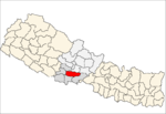 Categories:
- Populated places in Palpa District
- Lumbini Zone geography stubs


Wikimedia Foundation. 2010.