- Darlamdanda
-
Darlamdanda — Village development committee — Location in Nepal
 Darlamdanda
Coordinates: 27°55′N 83°37′E / 27.91°N 83.61°ECoordinates: 27°55′N 83°37′E / 27.91°N 83.61°E Country  Nepal
NepalZone Lumbini Zone District Palpa District Population (1991) – Total 2,389 Time zone Nepal Time (UTC+5:45) Darlamdanda is a village development committee in Palpa District in the Lumbini Zone of southern Nepal. At the time of the 1991 Nepal census it had a population of 2389 people living in 469 individual households.[1]
This VDC shares its borders with Khanichhap VDC in the east, Nayar Namtalesh and Chappani VDCs in the south, Yamgha VDC in the west, and Syangja district on the north. The holy place Ramdi on the bank of Kali Gandaki river is located in this VDC. The famous and unique Ramdi-pul (bridge) in the Palpa Syangja section of Siddarath Highway is located here. There are special occasions like haribodhani ekadashi (also called Kattike Thuliekadashi), baishakhe sakranti (Nepali new year) that people from neighbouring VDCs and districts visit here.
Darlamdanda Higher Secondary School is one of the major educational institutions in the area. It was established in 2013 BS (Bikram Sambat) as a primary school. It has been upgraded to higher levels in different steps and now classes run upto 12th grade. This school has a huge impact on the educational life of the people in the remote north of the district headquarter.
The climate in the area is very nice all yeararound. The snowfall is a rare case almost no record so far. It rains heavily in the summer. There is no irrigation facility so farmers have to depend on the rain (monsoon). The climate is very friendly to grow variety of fruits, vegetables, and grains.
This place was also known for the Sani Ukali (short but steeper climbings) on the way from Ramdi to Tansen and the Thuli Ukali (big one) in the neighbouring Chappani VDC. There was a project,around 1991 AD (2047 BS) to improve this historical trekking road from Ramdi to Tansen and some section of this was upgraded nicely. However, the work was not completed. After few years, another project started to provide a roadway from Tansen to Ramdi. This included a very hard work of the local people. By 2008 AD (2065 BS) the first phase of it was completed. Except for heavily raining seasons, there is a transportation service available from Butwal and Tansen to Darlamdanda and neighbouring village development committees.
In Nepali, the name of this place is दर्लमडांडा (and not the दर्लामडांडा as it sounds so from the spelling DARLAMDANDA). The ward number one of Darlamdanda VDC also has the same name Darlamdanda. There is a tale\story why the name is darlamdanda, many many years ago there were people living with their last name Darlami and geographically the place is a hill/mountain (with meaning डांडा in Nepali language). With this combination the place is now known as दर्लमडांडा. However, majority of the people living in Darlamdanda today have a very different last name (Gaire) compared to the historic last name (Darlami).
The population of the Darlamdanda VDC is very diverse. This obviously has impact on the social, cultural, educational, and economical life of the people living there.
References
- ^ "Nepal Census 2001". Nepal's Village Development Committees. Digital Himalaya. http://www.digitalhimalaya.com/collections/nepalcensus/form.php?selection=1. Retrieved 12 December 2008.
Archale, Argali, Bahadurpur, Baldengadhi, Bandi Pokhara, Barandi, Bhairabsthan, Bhuwan Pokhari, Birkot, Bodhapokharathok, Boudhagumba, Chappani, Chhahara, Chidipani, Chirtungdhara, Darchha, Darlamdanda, Deurali, Devinagar, Dobhan, Feka, Foksingkot, Gadakot, Galgha, Gegha, Gothadi, Haklang, Humin, Hungi, Jalpa, Jhadewa, Jhirubas, Juthapauwa, Jyamire, Kachal, Kaseni, Khaliban, Khaniban, Khanichhap, Khanigau, Khasyoli, Khyaha, Koldada, Kusumkhola, Madanpokhara, Mainadi, Masyam, Mityal, Mujhung, Narayanmatales, Palung Mainadi, Pipaldada, Pokharathok, Rahabas, Rampur, Ringneraha, Rupse, Sahalkot, Satyawati, Siddheshwor, Siluwa, Somadi, Tahu, Telgha, Thu, Timurekha, Bakamalang, Yangha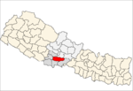 Categories:
- Populated places in Palpa District


Wikimedia Foundation. 2010.