Mtshabezi Dam

Mtshabezi Dam
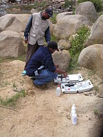
University of Zimbabwe research students sampling water near Mtshabezi Dam.

Mtshabezi Dam is a reservoir on the Mtshabezi River, Zimbabwe with a capacity of 11.4 Mm3. It will augment the water supply for the City of Bulawayo, once a connecting pipeline has been completed.[1]

References

  1. ^ Chibi, T., Kandori, C. and Makone, B.F. 2005. Mzingwane Catchment Outline Plan. Zimbabwe National Water Authority, Bulawayo.

Coordinates: 20°34′21″S 28°50′42″E / 20.5725°S 28.845°E / -20.5725; 28.845


Wikimedia Foundation. 2010.

Игры ⚽ Нужно решить контрольную?

Look at other dictionaries:

  • Mtshabezi Mission —   Ward   Country  Zimbabwe Province …   Wikipedia

  • Mtshabezi River — Not to be confused with Umchabezi River. The Mtshabezi River where it flows through Gwanda …   Wikipedia

  • Oakley Block Dam — False colour composite satellite image showing the middle Mzingwane River.[1] The site for Oakley Block Dam is the mountains in the centre of the image. Oakley Block Dam is a proposed reservoir on the Mzingwane River, south of West Nicholson,… …   Wikipedia

  • Mzingwane River — above Fulton s Drift (causeway), near Beitbridge, Zimbabwe Origin south of Bulawayo, Zimbabwe …   Wikipedia

  • Manama, Zimbabwe — Manama   Ward   Country  Zimbabwe Province …   Wikipedia

  • Manama (village) — Location of Manama …   Wikipedia

  • Manama High School — is a Lutheran mission school at Manama in Gwanda District, Zimbabwe. The school has a very successful girl s football team, which competed in the Norway Cup in 2010.[1] References ^ Manama girls soccer team off to Oslo . ZImbabweSitauation. 23… …   Wikipedia

  • Matshetshe —   Ward   Country  Zimbabwe Province …   Wikipedia

  • Mtshazo —   Ward   Country  Zimbabwe Province …   Wikipedia

  • Mzimuni, Zimbabwe — Mzimuni   Ward   Country  Zimbabwe Province …   Wikipedia

Share the article and excerpts

Direct link
Do a right-click on the link above
and select “Copy Link”