- Mount Bwahit
-
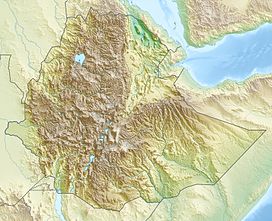
Bwahit Buahit Location in Ethiopia Elevation 4,437 m (14,557 ft) [1] Prominence 800 m (2,625 ft) Location Location Semien Mountains, Amhara Region, Ethiopia Coordinates 13°14′38″N 38°13′4″E / 13.24389°N 38.21778°ECoordinates: 13°14′38″N 38°13′4″E / 13.24389°N 38.21778°E Mount Bwahit (or Buahit, Bachit, Buiheat) is a peak of the Semien Mountains in the Amhara Region of Ethiopia. Its altitude is estimated at 4430 or 4437 m above sea level, making it the second highest mountain in Ethiopia. It is located about 16 km west of the highest, Ras Dashen, from which it is separated by a 1,600 m deep gorge. The connecting ridge to Ras Dashen is lowest at the Arkwasiye Pass (ca. 3635 m) NNE of Bwahit.
References
- ^ Ethiopian Mapping Authority. 2010 National Statistics (Abstract): climate, Table A.1. Central Statistical Agency website (accessed 5 October 2011)
Categories:- Semien Mountains
- Mountains of Ethiopia
- Amhara geography stubs
Wikimedia Foundation. 2010.

