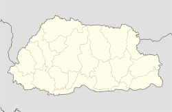
Motithang

Motithang
Motithang
—  District of Thimphu  —
Motithang is located in Bhutan
Motithang
Coordinates: 27°28′28″N 89°37′22″E / 27.47444°N 89.62278°E / 27.47444; 89.62278Coordinates: 27°28′28″N 89°37′22″E / 27.47444°N 89.62278°E / 27.47444; 89.62278
Country  Bhutan
District Thimphu District
City Thimphu

Motithang is a north-western suburb of Thimphu, Bhutan. The Chubachu River divides the district from Kawajangsa further north and Chubachu district lies to the east.

Meaning "the meadow of pearls", the area only developed as a residential area in the 1980s, following the initial establishment of the Motithang Hotel in 1974, on the occasion of the coronation of Jigme Singye Wangchuck.[1] At the time, the hotel was located in the middle of forest, separated from the city by farmland but today this area has grown up with houses and gardens.

Aside from the Motithang Hotel, the district contains several notable state guest houses such as the Kungacholing and Lhundupling, Rapten Apartments and the Amankora Thimphu.[1] It also contains the National Commission for Cultural Affairs, a UNICEF station and several grocery stores, including the Lhatshog supermarket.[1]Schools include Motithang School and Jigme Namgyal School.

There is also a notable takin wildlife sanctuary in the district, named Motithang Takin Preserve.

References

  1. ^ a b c Pommaret, Francoise (2006). Bhutan Himlayan Mountains Kingdom (5th edition). Odyssey Books and Guides. pp. 181. 

Wikimedia Foundation. 2010.

Игры ⚽ Поможем решить контрольную работу

Look at other dictionaries:

  • Motithang Takin Preserve — Coordinates: 27°28′00″N 89°38′30″E / 27.4666667°N 89.64167°E / 27.4666667; 89.64167 …   Wikipedia

  • Hotel Motithang — Hotel Motithang …   Wikipedia

  • Википедия:Проект:Бутан — Проект «Бутан» Проект «Бутан»  создан для координации написания статей о Бутане, населении, культуре, политике, экономике, географии, истории Бутана и пр. Также планируется улучшение уже существующих статей о Бутане. Если Вам интересна тема… …   Википедия

  • Белый такин — ? Белый такин Научная классификация …   Википедия

  • Chubachu —   District of Thimphu   Country  Bhutan District Thimphu …   Wikipedia

  • Охраняемые природные территории Бутана — Список охраняемых природных территорий Бутана: Природный заказник Бумделинг (англ. Bumdeling Wildlife Sanctuary)[1] Национальный парк Джигме Дорджи (англ. Jigme Dorji National Park)[2] Национальный парк Джигме Сингье Вангчука (ранее… …   Википедия

  • Bhutan — Coordinates: 27°25′01″N 90°26′06″E /  …   Wikipedia

  • People's Democratic Party (Bhutan) — Infobox Political party party name = People s Democratic Party party colorcode = #324D7A leader = Sangay Ngedup chairman = spokesperson = foundation = March 24, 2007 ideology = Social Democracy, Liberalism, Gross National Happiness, Populism,… …   Wikipedia

  • Timbu — Timbu …   Wikipedia Español

  • Список футбольных клубов Бутана — Футбол в Бутане появился в 1950 х годах. Несмотря на возникший в первое время интерес к данному виду спорта, вскоре его популярность пошла на убыль. Новый подъём популярности футбола среди бутанцев в 1990 х годах связывают с деятельностью… …   Википедия

Share the article and excerpts

Direct link
Do a right-click on the link above
and select “Copy Link”