- Montilliez
-
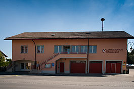
Montilliez Poliez-le-Grand town hall Country Switzerland 
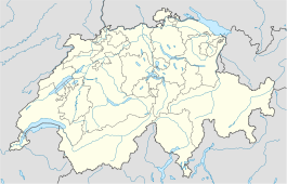
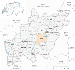
Canton Vaud District Gros-de-Vaud 46°39′N 6°40′E / 46.65°N 6.667°ECoordinates: 46°39′N 6°40′E / 46.65°N 6.667°E Population 1,404 (Dec 2009)[1] - Density 93 /km2 (241 /sq mi) Area 15.1 km2 (5.8 sq mi) Postal code SFOS number 5540 Surrounded by Fey, Villars-le-Terroir Website Montilliez.ch
Profile, SFSO statisticsMontilliez is a municipality in the district of Gros-de-Vaud in the canton of Vaud in Switzerland.
The municipalities of Dommartin, Naz, Poliez-le-Grand and Sugnens merged on 1 July 2011 into the new municipality of Montilliez.[2]
Contents
History
Dommartin is first mentioned in 908 as Domno Martino villa.[3] Naz is first mentioned around 1200 as Nars.[4] Poliez-le-Grand is first mentioned around 1160-79 as Poleto. In 1225 it was mentioned as Pollie lo Grant.[5] Sugnens is first mentioned in 1177 as Sugnens.[6]
Geography
Montilliez has an area, as of 2009[update], of 15.07 square kilometers (5.82 sq mi). Of this area, 10.13 km2 (3.91 sq mi) or 67.2% is used for agricultural purposes, while 3.72 km2 (1.44 sq mi) or 24.7% is forested. Of the rest of the land, 1.05 km2 (0.41 sq mi) or 7.0% is settled (buildings or roads).[7]
Historic Population
The historical population is given in the following chart:[3][4][5][6][8]

References
- ^ Swiss Federal Statistical Office, MS Excel document – Bilanz der ständigen Wohnbevölkerung nach Kantonen, Bezirken und Gemeinden (German) accessed 25 August 2010
- ^ Amtliches Gemeindeverzeichnis der Schweiz published by the Swiss Federal Statistical Office (German) accessed 17 February 2011
- ^ a b Dommartin in German, French and Italian in the online Historical Dictionary of Switzerland.
- ^ a b Naz in German, French and Italian in the online Historical Dictionary of Switzerland.
- ^ a b Poliez-le-Grand in German, French and Italian in the online Historical Dictionary of Switzerland.
- ^ a b Sugnens in German, French and Italian in the online Historical Dictionary of Switzerland.
- ^ Swiss Federal Statistical Office-Land Use Statistics 2009 data (German) accessed 25 March 2010
- ^ Federal Statistical Office STAT-TAB Bevölkerungsentwicklung nach Region, 1850-2000 (German) accessed 29 January 2011
Assens | Bercher | Bettens | Bioley-Orjulaz | Bottens | Boulens | Bournens | Boussens | Bretigny-sur-Morrens | Chapelle-sur-Moudon | Correvon | Cugy | Daillens | Denezy | Echallens | Essertines-sur-Yverdon | Etagnières | Fey | Froideville | Goumoëns | Jorat-Menthue | Lussery-Villars | Martherenges | Mex | Montilliez | Morrens | Neyruz-sur-Moudon | Ogens | Oppens | Oulens-sous-Echallens | Pailly | Penthalaz | Penthaz | Penthéréaz | Peyres-Possens | Poliez-Pittet | Rueyres | Saint-Barthélemy | Saint-Cierges | Sullens | Thierrens | Villars-le-Terroir | Vuarrens | Vufflens-la-Ville
Canton of Vaud | Districts of the canton of Vaud | Municipalities of the canton of Vaud

Wikimedia Foundation. 2010.


