- Mont Chaberton
-
Mont Chaberton 
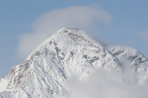
Southeast face of ChabertonElevation 3,131 m (10,272 ft) Location Hautes-Alpes,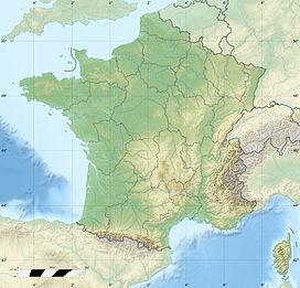
 Mont Chaberton
 France
Range Cottian Alps Coordinates 44°57′25″N 6°45′04″E / 44.95694°N 6.75111°ECoordinates: 44°57′25″N 6°45′04″E / 44.95694°N 6.75111°E Mont Chaberton is a 3,131 metres (10,272 ft) peak in the French Alps in the group known as the Massif des Cerces in the département of Hautes-Alpes.
Chaberton is in the municipality of Montgenèvre in the Briançonnais region. It is easily recognisable by its pyramidal shape and flat top.
History
 Ruined artillery batteries
Until 1947 Mont Chaberton was in Italy, located in the municipality of Cesana Torinese.
Between 1898 and 1910 Italian troops built an artillery battery on the summit that pointed towards France, in particular at the town of Briançon, and the pass to Italy over the Col de Montgenèvre. A road was built to the summit from the village of Fénils in the Susa Valley. The fort was dubbed the "Fort of the Clouds" and mounted eight 149mm guns in individual masonry turrets, which were often hidden in the clouds.[1]
When Italy entered the Second World War, they bombarded the French positions around Briançon, but they did not advance. On June 21, 1940 the 154th Artillery Regiment destroyed 6 of the 8 turrets using 280mm marine mortars which had served in The First World War at Verdun. These were placed out of sight at Poët Morand below Fort de l'Infernet and were guided by observers on the nearby Mont Janus. Shell craters are still visible from the air on the slopes to the west of the mountain
At the end of the war France acquired the mountain, and the border was moved to the edge of the Italian village of Claviere.
Geology
The rocks are from the upper Late Triassic period.
References
- Guide to the mountain
- Une victoire dans la défaite - La destruction du Chaberton, Briançon 1940, Max Schiavon éditions Anovi, 2007 ISBN2-91481-818-1
External links
Categories:- Alpine Three-thousanders
- Mountains of the Alps
- Mountains of Hautes-Alpes


Wikimedia Foundation. 2010.