- Moliro
-
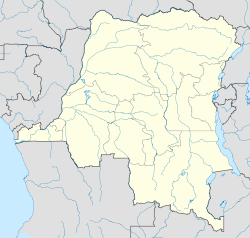
Moliro Coordinates: 8°13′15″S 30°33′59″E / 8.220962°S 30.566497°ECoordinates: 8°13′15″S 30°33′59″E / 8.220962°S 30.566497°E Country Democratic Republic of Congo Province Katanga Moliro is a community in the east of the Democratic Republic of the Congo beside Lake Tanganyika on the border with Zambia.[1] It is in Katanga Province.
The Congo Free State Enclave of Moliro was founded in 1902, with its own fort and detachment of soldiers, one of three such military divisions in northeastern Katanga.[2]
During the negotiations to end the Second Congo War (1998-2003), in March 2002 the rebel group Rassemblement Congolais pour la Démocratie (RCD-Goma) attacked and captured Moliro. The UN Security Council demanded that "RCD-Goma troops withdraw immediately and without condition from Moliro and ... all parties withdraw to the defensive positions called for in the Harare disengagement sub-plans".[3] The talks were suspended for two weeks until the RCD evacuated the village.[4]
References
- ^ "Rebel-held Moliro and Pweto in DR Congo to be demilitarised: UN". Agence France-Presse. March 22, 2002. http://reliefweb.int/node/97976. Retrieved 2011-10-31.
- ^ Vail, Leroy (1991). The Creation of Tribalism in Southern Africa. University of California Press. p. 199. ISBN 0520074203. http://books.google.ca/books?id=X4VmAWdXPD0C&pg=PA199.
- ^ "DR Congo: Security Council condemns capture of Moliro by RCD-Goma - Resolution 1399 (2002)". 19 Mar 2002. http://reliefweb.int/node/97773. Retrieved 2011-10-31.
- ^ Rose-Marie Bruballa (27 Mar 2002). "DR Congo rebels withdraw from Moliro: UN". Agence France-Presse. http://reliefweb.int/node/98245. Retrieved 2011-10-31.
Categories:- Democratic Republic of the Congo geography stubs
- Populated places in Katanga Province
Wikimedia Foundation. 2010.

