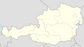
- Mils, Tyrol
-
For Mils near Imst, Austria, see Mils bei Imst.
Mils Country Austria State Tyrol District Innsbruck Land Mayor Peter Hanser (AKM) Area 6.93 km2 (3 sq mi) Elevation 605 m (1985 ft) Population 4,151 (1 January 2011)[1] - Density 599 /km² (1,551 /sq mi) Time zone CET/CEST (UTC+1/+2) Licence plate IL Postal code 6068 Area code 05223 Website www.gemeinde.mils-tirol.at Coordinates: 47°17′11″N 11°31′36″E / 47.28639°N 11.52667°E
Mils is a municipality in the district Innsbruck-Land and is located 12 km east of Innsbruck. The area is restricted by the Weißenbach (Hall in Tirol / Mils) in the west and the Inn River in the south. The location was mentioned in documents in 930 for the first time. In the last 40 years Mils grew enormous thanks to its sunny location. It possesses 4087 inhabitants.
References
External links
- Municipality Mils: Official website of the municipality in the Hall-Wattens region
Absam · Aldrans · Ampass · Axams · Baumkirchen · Birgitz · Ellbögen · Flaurling · Fritzens · Fulpmes · Gnadenwald · Götzens · Gries am Brenner · Gries im Sellrain · Grinzens · Gschnitz · Hall in Tirol · Hatting · Inzing · Kematen in Tirol · Kolsass · Kolsassberg · Lans · Leutasch · Matrei am Brenner · Mieders · Mils · Mühlbachl · Mutters · Natters · Navis · Neustift im Stubaital · Oberhofen im Inntal · Obernberg am Brenner · Oberperfuss · Patsch · Pettnau · Pfaffenhofen · Pfons · Polling in Tirol · Ranggen · Reith bei Seefeld · Rinn · Rum · Sankt Sigmund im Sellrain · Scharnitz · Schmirn · Schönberg im Stubaital · Seefeld in Tirol · Sellrain · Sistrans · Steinach am Brenner · Telfes · Telfs · Thaur · Trins · Tulfes · Unterperfuss · Vals · Volders · Völs · Wattenberg · Wattens · Wildermieming · Zirl
Categories:- Cities and towns in Tyrol
- Tyrol geography stubs
Wikimedia Foundation. 2010.


