- Mill Road, Cambridge
-

Mill Road is a street in southeast Cambridge, England.[1] It runs southeast from near to Parker's Piece, at the junction with Gonville Place, East Road, and Parkside. It crosses the main railway line and links to the city's ring road (the A1134). It passes through the wards of Petersfield and Romsey, which are divided by the railway line. It is a busy, cosmopolitan street home to many independent businesses, churches, a Hindu temple and the city's mosque.
Near the northwestern end to the south in Mortimer Road off Mill Road is Hughes Hall, one of the University of Cambridge colleges. Behind Hughes Hall is Fenner's, the cricket ground of the University of Cambridge, which has hosted first-class cricket since 1848. To the north is Anglia Ruskin University, formerly Cambridgeshire College of Arts and Technology (CCAT).
Contents
History
Mill Road was originally a quiet country lane leading to the southeast out of the city of Cambridge, named after the windmill that stood at what is now the corner of Covent Garden. The coming of the railways in the mid-19th century brought about a rapid development of the eastern part of the city after Cambridge University repeatedly blocked attempts to build a more central station.[2] The population of the Mill Road area was listed as 252 in 1801, 6,651 in 1831, 11,848 in 1861 and 25,091 in 1891.[3]
Petersfield and Romsey Town, the areas of Mill Road to either side of the railway bridge, developed in markedly different ways.
Petersfield, to the west of the railway, was originally developed by Gonville and Caius and Corpus Christi colleges (a fact reflected in the naming of the area’s streets after college fellows).[3] In 1838 the Cambridge Union Workhouse was opened, a building subsequently to become the Mill Road Maternity Hospital and finally a sheltered housing scheme.[4]
Romsey Town, east of the railway, started to be developed after the inclosure acts of the middle 19th century. Expansion of the railway network drove the building of housing for railway workers and the majority of the houses were built in the ten years after 1885.[5]
Historically Petersfield has always been thought of by local residents as being on the 'Gown' side of the town and gown divide, with many of the residents having been employed by the University. Romsey, on the other hand, remained predominantly working class with a socialist tradition in its local politics, becoming known locally as 'Red Romsey' or 'Little Russia'.[5]
Mill Road Winter Fair
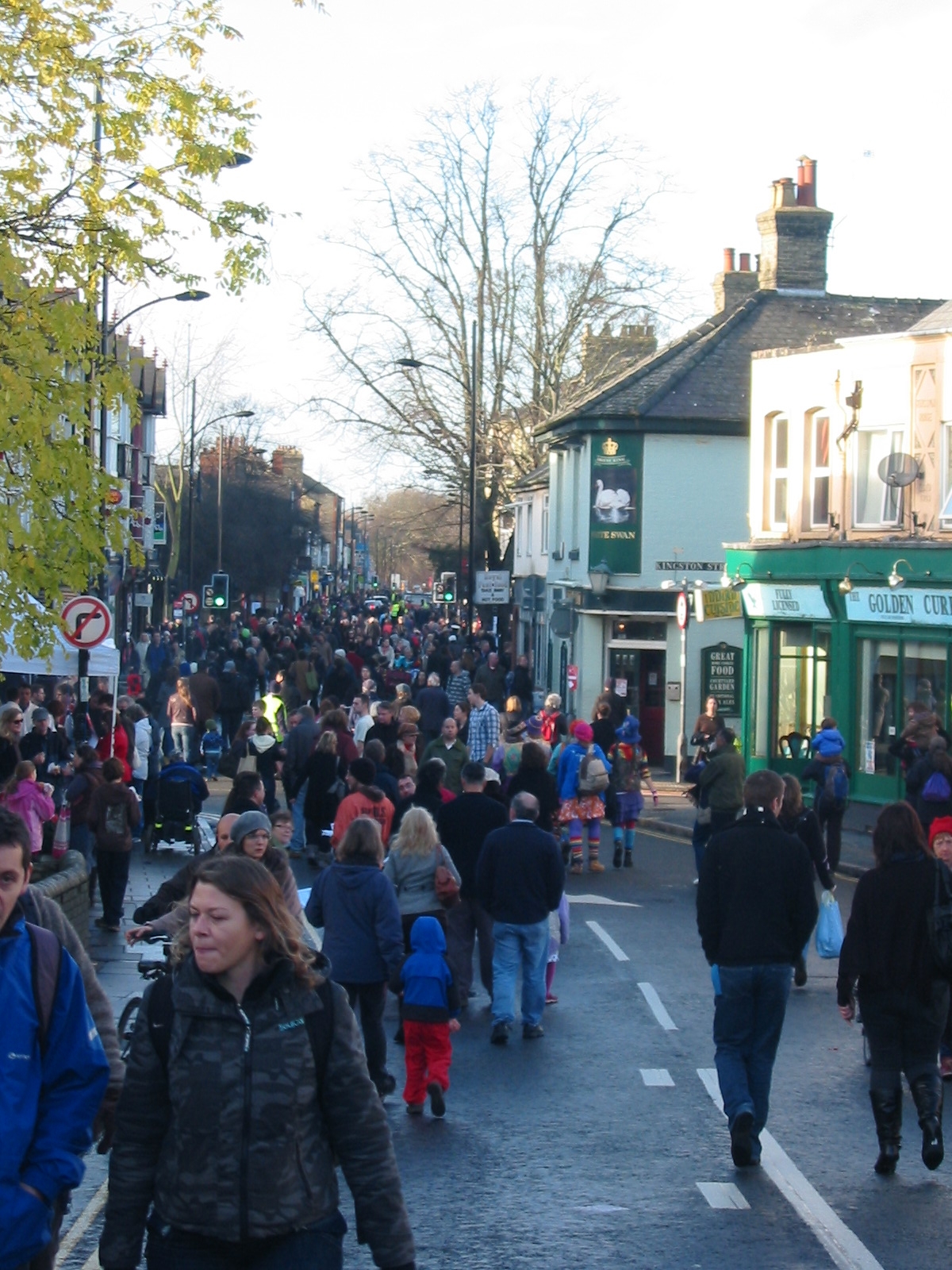
The Mill Road Winter Fair[6] is an annual fair on the first Saturday in December. Attendance has grown from 10,000 at the first fair in 2005[7] to at least 20,000 in 2009[8]. Since 2009 part of Mill Road, including the bridge, has been closed to traffic for the duration of the fair. Regular activities include shop a window display competition, live music, folk dancing, a local history walk and open days at the road's churches, temple and mosque.[9]
- Mill Road
-
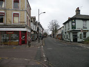
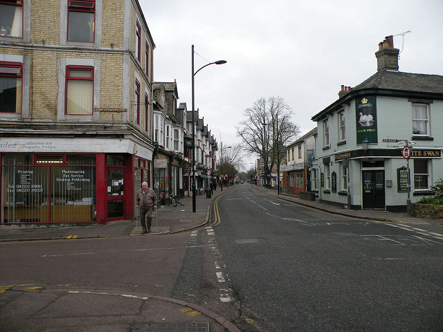
Mill Road, looking toward the city.
-
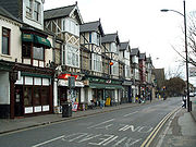
Independent shops.
-
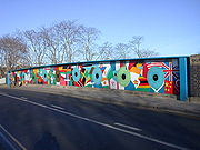
Railway bridge mural.
-
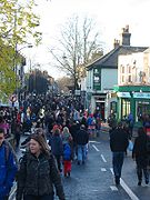
The 2009 Mill Road Winter Fair.
Notable residents
The following live or have lived in the Mill Road area:
- Douglas Adams — author. Born at Mill Road Maternity Hospital, 1952.[10]
- Syd Barrett — musician. Born at 60 Glisson Road, 1946. Attended Cambridgeshire College of Arts and Technology (now Anglia Ruskin University) with David Gilmour, 1962-64.[11]
- Robert Carpenter - cricketer. Born 18 November 1830 in Mill Road.
- Susanna Clarke - author (Jonathan Strange & Mr Norrell).[12]
- Rajani Palme Dutt - communist ideologue and vice-chairman of the British Communist Party (CPGB). Born 1896 in 25 Mill Road, where his father Upendra Krishna Dutt had a medical practice.[13] The building now houses the Petersfield Medical Practice.
- Gordon Fraser — publisher. Lived at 274a Mill Road during the late 1930s. Dylan Thomas attended a notorious week-long drunken party there in 1937 after coming to Cambridge to give a reading.[14]
- Fred Hoyle — astronomer and mathematician. Lived on Mill Road as an undergraduate in Emmanuel College digs, 1933-35.[15]
- Tom Karen — designer of the Reliant Scimitar GTE, Bond Bug and Raleigh Chopper bicycle.[16]
- F.R. Leavis — notable British literary critic. Born above his father's music shop at 69 Mill Road, 1895.[14]
- Tom Sharpe — author. Lived on Mill Road while lecturing in History at CCAT between 1963 and 1972.[14]
- Amy Williams — 2010 Winter Olympics women's Skeleton gold medalist.
References
- ^ Mill Road, Cambridge Online.
- ^ Gray, Adrian (1976). "Cambridge’s quest for a central station". Journal of the Railway and Canal Historical Society 22: 22–4.
- ^ a b Ronald D. Gray, Derek Stubbings, Cambridge street-names: their origins and associations. Cambridge University Press, 2000. ISBN 0521789567, ISBN 9780521789561.
- ^ Mill Road, Maternity Hospital, Cambridge University Hospitals.
- ^ a b Alan Brigham and Colin Wiles, Bringing it all back home. CIH, 2006.
- ^ Mill Road Winter Fair
- ^ Report of First Fair, Cambridge Evening News
- ^ Report of 2009 Fair, Cambridge Evening News
- ^ Winter Fair timetable 2010
- ^ Hitchhiker: A Biography of Douglas Adams (Paperback) — M.J. Simpson. Coronet Books 2004. ISBN 978-0340824894.p.6
- ^ Crazy diamond: Syd Barrett & the dawn of Pink Floyd — Mike Watkinson and Pete Anderson. Omnibus Press, 2001. ISBN 0711988358, ISBN 9780711988354.
- ^ "New chapter on screen for Susanna's book". Cambridge News. http://www.cambridge-news.co.uk/Cambridge/New-chapter-on-screen-for-Susannas-book.htm. Retrieved 8 September 2011.
- ^ Rajani Palme Dutt Collection, People's History Museum, Manchester.
- ^ a b c Graham Chainey, A literary history of Cambridge. CUP Archive, 1995. ISBN 052147681X, ISBN 9780521476812.
- ^ Conflict in the cosmos: Fred Hoyle's life in science - Simon Mitton. National Academies Press, 2005. ISBN 0309093139, ISBN 9780309093132. p.28
- ^ "Tom Karen". FX Magazine. http://www.fxmagazine.co.uk/story.asp?sectioncode=41&storycode=3009&c=2. Retrieved 8 March 2010.
External links
Categories:- Streets in Cambridge
- Streets associated with the University of Cambridge
- History of Cambridge
- Hughes Hall, Cambridge


Wikimedia Foundation. 2010.