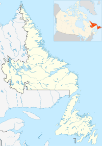
Mill Cove, Newfoundland and Labrador
- Mill Cove, Newfoundland and Labrador
-
Categories:
- Populated places in Newfoundland and Labrador
- Newfoundland and Labrador geography stubs
Wikimedia Foundation.
2010.
Look at other dictionaries:
Victoria Cove, Newfoundland and Labrador — Victoria Cove, Newfoundland is situated on the west side of Gander Bay, near the town of Gander. Victoria Cove was originally called Little House Cove and was visited since the mid 1800s by fishermen who would do woods work in the winter.… … Wikipedia
Newfoundland and Labrador — This article is about the Canadian province of Newfoundland and Labrador. For the island that makes up part of it, see Newfoundland (island). For other meanings of Newfoundland , see Newfoundland. Newfoundland and Labrador … Wikipedia
New Harbour, Newfoundland and Labrador — New Harbour Nieu Hoek (Dutch) Local Services District … Wikipedia
Safe Harbour, Newfoundland and Labrador — Safe Harbour is an abandoned outport on the northeast coast of Newfoundland in the Canadian province of Newfoundland and Labrador.HistorySafe Harbour was situated on the northern shore of Bonavista Bay, between Greenspond and the Valleyfield,… … Wikipedia
List of communities in Newfoundland and Labrador — This page lists communities of the province of Newfoundland and Labrador, Canada. Incorporated towns or cities are recognized as census subdivisions by Statistics Canada and can be found on List of cities and towns in Newfoundland and Labrador.… … Wikipedia
St. John's, Newfoundland and Labrador — Not to be confused with Saint John, New Brunswick. St. John s City … Wikipedia
Smith Sound (Trinity Bay, Newfoundland and Labrador) — Smith Sound is a zigzag 24 kilometer inner region of Trinity Bay. This sound is one of the longest portions of inshore waterways in Newfoundland, located on its north eastern coast in the Canadian province of Newfoundland and Labrador. Bonavista… … Wikipedia
Southport, Newfoundland and Labrador — Southport is a community in the Canadian province of Newfoundland and Labrador, located on the southern side of the entrance to Trinity Bay s Southwest Arm, about 41 km southeast of Clarenville. Its latitude and logitude are 48°02 59 N, 53°37 59… … Wikipedia
Springdale, Newfoundland and Labrador — Infobox Settlement official name = Springdale other name = Wolf Cove native name = nickname = settlement type = Town motto = imagesize = image caption = flag size = image seal size = image shield = shield size = city logo = citylogo size =… … Wikipedia
Clarenville, Newfoundland and Labrador — Infobox Settlement official name = Clarenville other name = native name = nickname = settlement type = Town motto = imagesize = image caption = flag size = image seal size = image shield = shield size = city logo = citylogo size = pushpin pushpin … Wikipedia

