- Miles City Airport
-
Miles City Airport
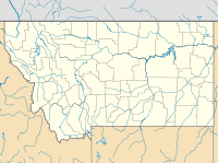
Frank Wiley FieldIATA: MLS – ICAO: KMLS – FAA LID: MLS Location of the Montana Summary Airport type Public Owner Miles City Serves Miles City, Montana Elevation AMSL 2,630 ft / 802 m Coordinates 46°25′41″N 105°53′10″W / 46.42806°N 105.88611°W Runways Direction Length Surface ft m 12/30 5,624 1,714 Asphalt 4/22 5,680 1,731 Asphalt Statistics (2007) Aircraft operations 11,200 Based aircraft 22 Sources: Airport[1] and FAA[2] Miles City Airport[1] or Frank Wiley Field[2] (IATA: MLS, ICAO: KMLS, FAA LID: MLS) is a city-owned, public-use airport located two nautical miles (3.7 km) northwest of the central business district of Miles City, in Custer County, Montana, United States.[2] This airport is included in the FAA's National Plan of Integrated Airport Systems for 2009–2013, which categorized it as a general aviation facility.[3] It is also designated to receive commercial service subsidized by the federal Essential Air Service (EAS) program.
Scheduled air service at Miles City ended on March 8, 2008, when Big Sky Airlines (the designated EAS operator) ceased operation. Great Lakes Airlines has been given USDOT approval to take over EAS service between Miles City and Billings, Montana.[4] In June, 2011, Gulfstream International Airlines began serving Miles City, replacing Great Lakes.
Contents
Facilities and aircraft
Frank Wiley Field covers an area of 1,640 acres (660 ha) at an elevation of 2,630 feet (802 m) above mean sea level. It has two asphalt paved runways: 12/30 is 5,624 by 100 feet (1,714 x 30 m) and 4/22 is 5,680 by 75 feet (1,731 x 23 m).[2]
For the 12-month period ending June 30, 2007, the airport had 11,200 aircraft operations, an average of 30 per day: 71% general aviation and 29% air taxi. At that time there were 22 aircraft based at this airport: 91% single-engine and 9% multi-engine.[2]
Airlines and destinations
Airlines Destinations Gulfstream International Airlines Billings, Glendive References
- ^ a b Miles City Airport (Frank Wiley Field) page at Miles City website
- ^ a b c d e FAA Airport Master Record for MLS (Form 5010 PDF). Federal Aviation Administration. Effective 29 July 2010.
- ^ National Plan of Integrated Airport Systems for 2009–2013: Appendix A: Part 3 (PDF, 1.28 MB). Federal Aviation Administration. Updated 15 October 2008.
- ^ "Great Lakes prepares for Montana routes". Sidney Herald. December 30, 2007. http://www.sidneyherald.com/articles/2007/12/30/news/news01.txt. Retrieved February 3, 2008.
- Essential Air Service documents (Docket Number 2605) from the U.S. Department of Transportation:
- Order 2008-7-9: approving alternate service pattern, Great Lakes Aviation changing communities' hub from Billings to Denver.
- Order 2007-12-22: allowing Big Sky Transportation Co., d/b/a Big Sky Airlines, to suspend its subsidized essential air services at seven Montana communities on the date that Great Lakes Aviation, Ltd., begins replacement service, and (b) selecting Great Lakes to provide those services at subsidy rates totaling $8,201,992 annually.
External links
- FAA Terminal Procedures for MLS, effective 20 October 2011
- Resources for this airport:
- AirNav airport information for KMLS
- ASN accident history for MLS
- FlightAware airport information and live flight tracker
- NOAA/NWS latest weather observations
- SkyVector aeronautical chart, Terminal Procedures for KMLS
Categories:- Airports in Montana
- Buildings and structures in Custer County, Montana
- Essential Air Service
- Transportation in Custer County, Montana
Wikimedia Foundation. 2010.

