- Mercer Ice Stream
-
 Ice streams in Antarctica
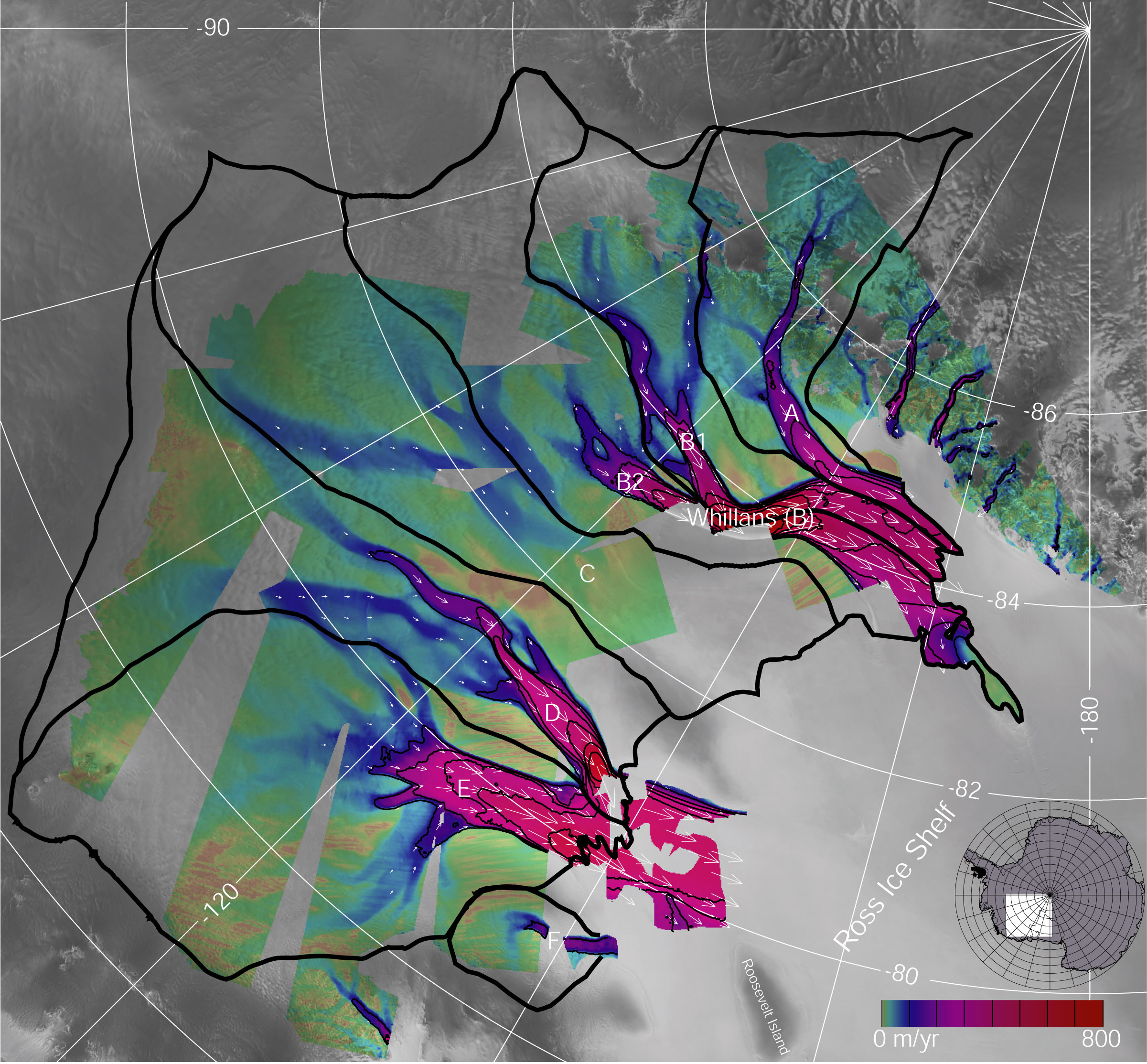
Mercer Ice Stream (84°50′S 145°00′W / 84.833°S 145°W), formerly Ice Stream E, flows west to Gould Coast to the south of Whillans Ice Stream, Antarctica. It is the southern most of several major ice streams draining from Marie Byrd Land into the Ross Ice Shelf. The ice streams were investigated and mapped by USARP personnel in a number of field seasons from 1983–84 and named Ice Stream A, B, C, etc., according to their position from south to north. The name was changed by US-ACAN in 2002 to honor John H. Mercer (1922–87), Quaternary geologist, Institute of Polar Studies (now Byrd Polar Research Center), Ohio State University, who mapped the moraines above Reedy Glacier and in Ohio Range at the head of Horlick Ice Stream, the major tributaries to Mercer Ice Stream.[1]
See also
- List of glaciers in the Antarctic
- List of Antarctic ice streams
References
 This article incorporates public domain material from the United States Geological Survey document "Mercer Ice Stream" (content from the Geographic Names Information System).
This Marie Byrd Land location article is a stub. You can help Wikipedia by expanding it.