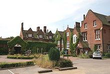
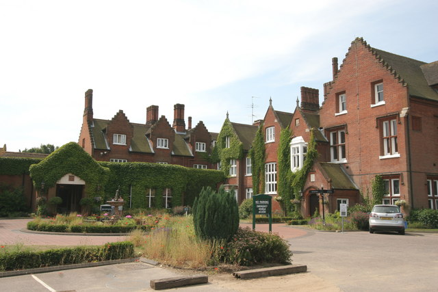
Sprowston Manor

Sprowston Manor

Coordinates: 52°39′50″N 1°20′28″E / 52.664°N 1.341°E / 52.664; 1.341

Sprowston Manor

Sprowston Manor was built in the 16th century as a manor house and is now part of the Marriott International group of hotels. The hotel is located at Sprowston near the city of Norwich.

The golf course at Sprowston Manor replaced the hotel's original layout in 2003, incorporating an additional 20 hectares to produce a course measuring 6500 yards, with a par of 71 and including 70 bunkers.[1]

External links

References


Wikimedia Foundation. 2010.

Игры ⚽ Нужна курсовая?

Look at other dictionaries:

  • Marriott Sprowston Manor Hotel and Country Club — Marriott Sprowston Manor Hotel was built in the 16th century as a manor house and is now part of the Marriott International group of hotels. The hotel located in heart of Norfolk near the city of Norwich.The golf course at Sprowston Manor… …   Wikipedia

  • Sprowston — Infobox UK place country = England official name= SPROWSTON population = 14027 shire district= Broadland region = East of England shire county = Norfolk static static image caption= Medieval glass in the parish church constituency westminster=… …   Wikipedia

  • A1151 road — UK road routebox road = A1151 length mi = 12.1 length km = 19.5 direction = South West North East start = Norwich destinations = end = near Smallburgh construction date = completion date = junctions = ukroadsmall|147 ukroadsmall|1042… …   Wikipedia

  • Civil ceremony — A civil registrar ceremony is a non religious legal marriage ceremony performed by a government official or functionary. In the UK, this person is normally called a registrar. In American jurisdictions, civil registrar ceremonies may be performed …   Wikipedia

  • List of schools in the East of England — The following is a partial list of currently operating schools in the East region of England. You may also find of use to find a particular school. See also the List of the oldest schools in the United Kingdom.Listed by local education authority… …   Wikipedia

  • Norwich — For other places with the same name, see Norwich (disambiguation). City of Norwich Norwich city centre …   Wikipedia

  • Horsham St Faith and Newton St Faith — Coordinates: 52°41′14″N 1°16′42″E / 52.6872°N 1.2782°E / 52.6872; 1.2782 …   Wikipedia

  • Belaugh — Coordinates: 52°42′58″N 1°23′14″E / 52.716019°N 1.387196°E / 52.716019; 1.387196 …   Wikipedia

Share the article and excerpts

Direct link
Do a right-click on the link above
and select “Copy Link”