- Market Square (Ivano-Frankivsk)
-
Coordinates: 48°55′21″N 24°42′36″E / 48.922479°N 24.710118°E
Market Square in Ivano-Frankivsk is called Ploshcha Rynok (Ukrainian: Площа Ринок) and is historically the central square of the city. It is the oldest square and traces its history to the city's establishment. The main feature of the square is the former city hall, Ratusha, which today serves as the building of the Museum of regional studies.Contents
Composition
The square is rectangular in shape with one major street running through its western side, the Halych Street. Halych Street is one of the major transportation arteries of the city and is part of the Ratusha, the former city's town hall. Just south of the Ratusha is located a fountain in the form of an egg. The square is surrounded by rows of some commercial and residential houses of two-three stories high.
On the western side a single row of buildings splits the Market Square from the Sheptytsky Square named after Andriy Sheptytsky. To the south another row of building separates the square from the picturesque Mickiewicz Square. At the south-western corner is located the Saint Resurrection Cathedral (former temple of Jesuits). Couple of hundred meters to the north of the square is located the city's market and the Central Department Store, known as TsUM. To the north-east are located the Potocki Palace (Military Hospital) and the Municipal/Regional Administration Building (Bilyi Dim). Behind the eastern row of buildings is located the Armenian Church, also known as the Blue Church, as well as the Ivano-Frankivsk Regional Philharmony (Orchestra Hall).
Houses
Eastern side
- Number 2. Sherematy Street. A two story house is located at the northeaster corner of the square facing west. It is part of a five-buildings row. The first floor is rented by various businesses, second floor - residential.
- Number 2a. Sherematy Street. A three-and-half-story building that is located right next to the previous one. It is known as the Trade Center "Maidan".
Southern side
- Number 8.
Western side
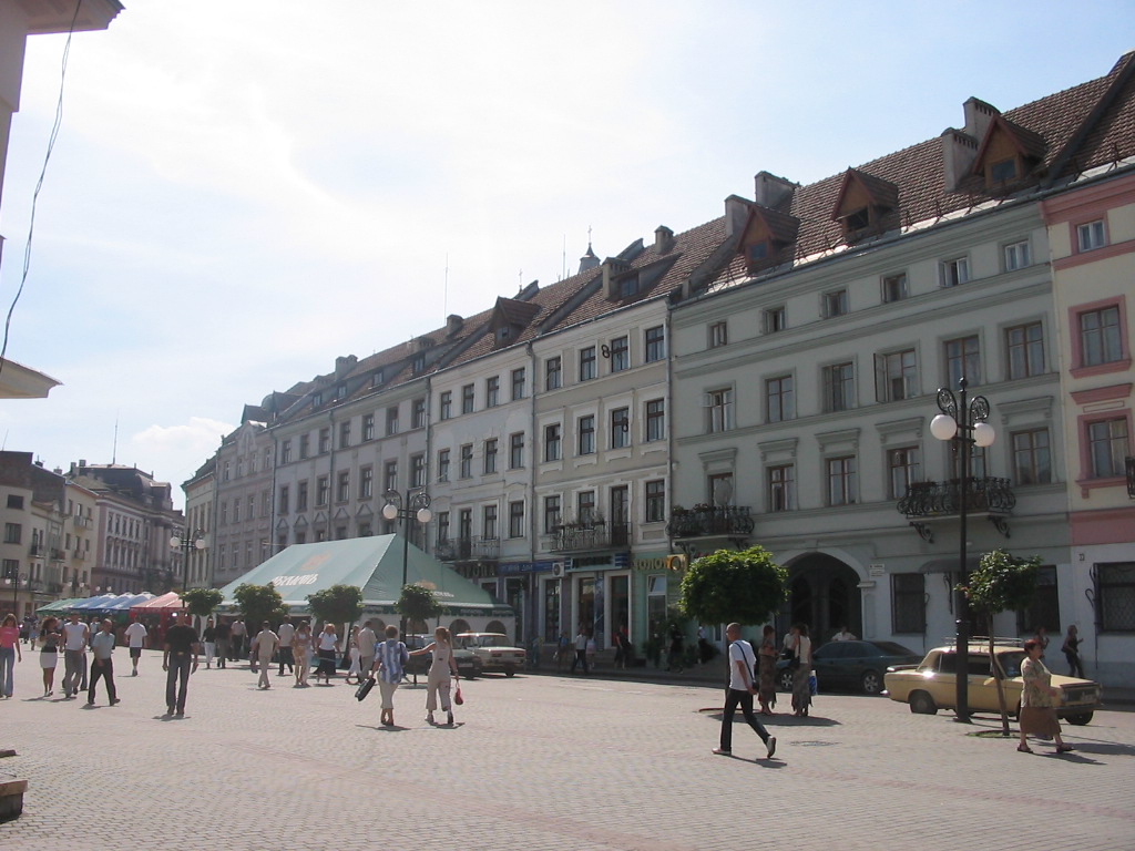
 The western side of the square - the Halych Street buildings, looking southwest. Similar buildings surround the rest of the Market Square.
- Number 29. Halych Street.
Northern side
Center
- Number 4a. Ratusha.
Statues and fountains
Minor Streets
The southern row of buildings is interrupted by the Trush Street which also connects the Market Square with Mickewicz Square near the Medical University and Lesya Ukrainka Street. At the southeastern corner of Rynok Square is located a small park, beyond which stretches another small street of Strachenykh. That streets runs towards the Oblast Philarmony located at eastern corner of the Mickewicz Square. The eastern row of buildings at the Market Square "cuts" the Melnychuk Street that starting from the square stretches straight towards the Hrushevsky Street and running past the Oblast/City administration building, the Bily Dim (White House).
References
External links
- (Ukrainian) Virtual Ivano-Frankivsk "Stanislav", travel the city while surfing the internet
- (Ukrainian) List of streets and squares of Ivano-Frankivsk
- (Russian) Rynok Square on a map at map.meta.ua
European Square · Liberation Square · Market Square · Mickiewicz Square · Pryvokzalna Square · Sheptytsky Square · Viche MaidanCategories:- Ivano-Frankivsk
- Town squares
Wikimedia Foundation. 2010.