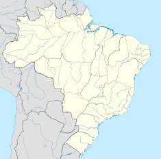
- Marimbondo Dam
-
Marimbondo Dam Location of Marimbondo Dam Official name Usina de Marimbondo Location Fronteira, Minas Gerais, Brazil Coordinates 20°18′14″S 49°11′52″W / 20.30389°S 49.19778°WCoordinates: 20°18′14″S 49°11′52″W / 20.30389°S 49.19778°W Construction began 1971 Opening date 1975 Dam and spillways Type of dam Embankment Height 94 m (308 ft) Length 3,100 m (10,200 ft) Crest width 10 m (33 ft) Volume 14,400,000 m3 (510,000,000 cu ft) Impounds Grande River Type of spillway Service, gate-controlled Spillway capacity 21,400 m3/s (760,000 cu ft/s) Reservoir Creates Marimbondo Reservoir Capacity 6,150,000,000 m3 (2.17×10¹¹ cu ft) Surface area 438 km2 (169 sq mi) Power station Commission date 1975-1977 Type Yes Turbines 8 x Francis-type Installed capacity 1,440 MW The Marimbondo Dam is an embankment dam on the Grande River near Fronteira in Minas Gerais, Brazil. The dam serves an associated hydroelectric power plant with a 1,440 MW installed capacity.[1]
Contents
Background
Owned and maintained by Eletrobrás Furnas, the dam was their fourth power plant constructed. Construction began in 1971 and was complete in 1975 when the first generator went online. The last of the eight generators went online in January 1977.[2]
Specifications
The Marimbondo Dam is a 3,100 m (10,200 ft) long and 94 m (308 ft) high earth-fill embankment dam with a concrete spillway and power house section. The total structural volume of materials for the dam is 14,400,000 m3 (510,000,000 cu ft). The dam's spillway contains nine floodgates that are 15 m (49 ft) wide and 18.85 m (61.8 ft) high each. In total, the spillway has a 21,400 m3/s (760,000 cu ft/s) discharge capacity. The reservoir created by the dam has a surface area of 438 km2 (169 sq mi) and capacity of 6,150,000,000 m3 (2.17×10¹¹ cu ft) with 5,260,000,000 m3 (1.86×10¹¹ cu ft) serving as live (active or "useful") storage. The normal reservoir level is 446.3 m (1,464 ft) above sea level and the maximum is 447.36 m (1,467.7 ft). The dam's power house is 25.3 m (83 ft) wide and 250.2 m (821 ft) long and contains eight 180 MW generators that are powered by Francis turbines.[2]
See also
- Luiz Barreto (Estreito) Dam
- Água Vermelha Dam
- Furnas Dam
- List of power stations in Brazil
References
- ^ "Hydroelectric Plants in Brazil - Minas Gerais". IndustCards. http://www.industcards.com/hydro-brazil-mg.htm. Retrieved 18 September 2010.
- ^ a b "Hydroelectric Plant Marimbondo (1,440 MW)" (in Portuguese). Eletrobras Furnas. http://www.furnas.com.br/hotsites/sistemafurnas/usina_hidr_marimbondo.asp. Retrieved 19 September 2010.
Categories:- Hydroelectric power stations in Brazil
- Dams in Brazil
- Earth-filled dams
Wikimedia Foundation. 2010.

