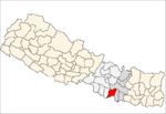
- Malangawa
-
Malangawa Location in Nepal Coordinates: 26°52′0″N 85°34′0″E / 26.866667°N 85.566667°ECoordinates: 26°52′0″N 85°34′0″E / 26.866667°N 85.566667°E Country  Nepal
NepalAdmin. division Janakpur Zone District Sarlahi District Elevation 79 m (262 ft) Population (1991) - Total 40,0,000 Malangawa or Malangwa is a town and municipality and the headquarters of Sarlahi District in the Janakpur Zone of Nepal. It is located at 26°52'0N 85°34'0E with an altitude of 79 metres (262 feet) near the border with India.[1]
At the time of the 1991 Nepal census it had a population of 14,142 people residing in 2403 individual households.[2]
References
- ^ Malangwa, Nepal Page - Falling Rain Genomics
- ^ "Nepal Census 2001". Nepal's Village Development Committees. Digital Himalaya. http://www.digitalhimalaya.com/collections/nepalcensus/form.php?selection=1. Retrieved November 2, 2008 My self Anil Thakur.
 Categories:
- Populated places in Sarlahi District
- Janakpur Zone geography stubs
Wikimedia Foundation. 2010.

