Maja e Radohimës

Maja e Radohimës
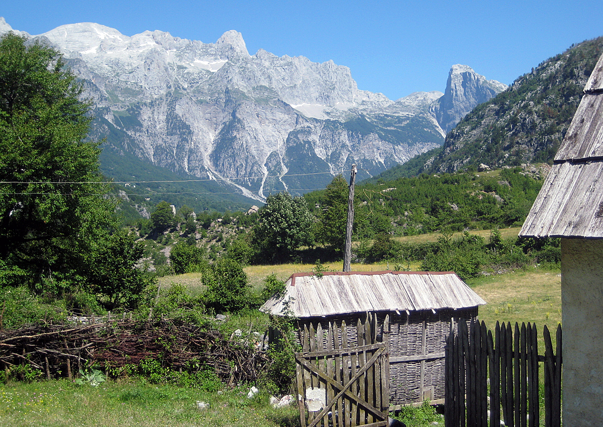
The Radohima massif as seen from Theth village

Maja e Radohimës is a mountain in the Albanian part of the Prokletije at a height of 2,570 m (8,432 ft). Its location is west of the Maja Jezercë at 2,694 m (8,839 ft) high.

References

Coordinates: 42°25′38″N 19°43′34″E / 42.4272°N 19.7260°E / 42.4272; 19.7260


Wikimedia Foundation. 2010.

Игры ⚽ Поможем сделать НИР

Look at other dictionaries:

  • Maja Jezercë — as seen from Maja Trojan Elevation 2,694 m (8,839 ft) …   Wikipedia

  • Maja Harapit — Massive south wall of Maja Harapit Elevation 2,218 m (7,277 ft) …   Wikipedia

  • Maja Tat — a mountain at 2,543 m high found in the northern part of Albania in the Prokletije range. Maja Radohimës at 2,570 m high is found close to Maja Tat in its eastern direction. It is known for its steep and dangerous slopes and rocky,… …   Wikipedia

  • Maja Visens — is a mountain in northern Albania in the Prokletije range. Maja Visens is found in the Radohimës Mountain area in the west of the range. Maja Visens is the third highest peak in these mountains being 2,517 m (8,258 ft) high. References… …   Wikipedia

  • Prokletije — Albanian: Bjeshkët e Namuna/Alpet Shqiptare Range …   Wikipedia

  • Prokletije — p5 Prokletije (Albanische Alpen) Nordalbanien …   Deutsch Wikipedia

  • Albanische Alpen — f1 Prokletije Höhe 2.693 m Lage Montenegro / Albanien / Kosovo Gebirge Dinarische Alpen …   Deutsch Wikipedia

  • Bjeshket e Nemuna — f1 Prokletije Höhe 2.693 m Lage Montenegro / Albanien / Kosovo Gebirge Dinarische Alpen …   Deutsch Wikipedia

  • Bjeshkët e Nemuna — f1 Prokletije Höhe 2.693 m Lage Montenegro / Albanien / Kosovo Gebirge Dinarische Alpen …   Deutsch Wikipedia

  • Nordalbanische Alpen — f1 Prokletije Höhe 2.693 m Lage Montenegro / Albanien / Kosovo Gebirge Dinarische Alpen …   Deutsch Wikipedia

Share the article and excerpts

Direct link
Do a right-click on the link above
and select “Copy Link”