- Mahabharat, Nepal
-
Mahabharat — Village development committee — Location in Nepal
 Mahabharat
Coordinates: 26°54′N 87°17′E / 26.90°N 87.28°ECoordinates: 26°54′N 87°17′E / 26.90°N 87.28°E Country  Nepal
NepalZone Kosi Zone District Dhankuta District Population (1991) - Total 3,633 Time zone Nepal Time (UTC+5:45) Mahabharat is a village development committee in Dhankuta District in the Kosi Zone of eastern Nepal. At the time of the 1991 Nepal census it had a population of 3633 people living in 683 individual households.[1]
References
- ^ "Nepal Census 2001". Nepal's Village Development Committees. Digital Himalaya. http://www.digitalhimalaya.com/collections/nepalcensus/form.php?selection=1. Retrieved 24 November 2008.
Ahale, Ankhisalla, Arkhaule Jitpur, Basantatar, Belhara, Bhdhabare, Bhirgaun, Bodhe, Budhabare, Budi Morang, Chanuwa, Chhintang, Chungmang, Danda Bazar, Dandagaun, Faksib, Falate, Ghortikharka, Hathikharka, Jitpur Arkhaule, Khoku, Khuwafok, Kuruletenupa, Leguwa, Mahabharat, Marek Katahare, Maunabuthuk, Mudebas, Muga, Murtidhunga, Pakhribas, Parewadin, Raja Rani, Sanne, Tankhuwa, Telia, Vedatar,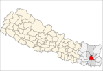 Categories:
- Populated places in Dhankuta District
- Kosi Zone geography stubs


Wikimedia Foundation. 2010.