- Port of Durrës
-
Port of Durrës 
Location Country Albania Location Durrës, Albania Coordinates 41°18′35″N 19°27′26″E / 41.30972°N 19.45722°E Details Opened Since Illyrians Operated by Durrës Port Authority Owned by Government of Albania Type of harbor Artificial Size of harbor 67 hectares Land area 80 hectares Employees 623 (2009) [1] Cargo company Cargotec [2] UNCTAD ALDRZ Depth 11.5 metres Statistics Annual cargo tonnage  1,601,321 tons (2010)
Annual container volume 66.000 TEU (2010)Passenger traffic 1.162.321 (2009) [3]Foto: 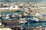
Website www.apdurres.com.al The Port of Durrës or Durrës Harbor (Albanian: Porti i Durrësit) is a biggest port of Albania in the city of Durrës, Albania.
It is an artificial basin that is formed between two moles, with a west-northwesterly oriented entrance approximately 183 metres (600 ft) wide as it passes between the ends of the moles. The Port of Durrës is located at the north end of the Bay of Durrës (Albanian: Gjiri i Durrësit), an extensive body of water between Kala e Turrës and Cape Durrës (Albanian: Kepi i Durrësit). Cape Durrës is located approximately 1.6 kilometres (0.99 mi) west of the Port of Durrës. [4]
The Port of Durrës has approximately 763 metres (2,503 ft) of alongside pier space on the West Mole and a fishing harbor lies at the north end of the East Mole. [5] Several wrecks are located near the entrance channel to the Port of Durrës. The use of tugboats is compulsory in the Port of Durrës. [6] As of 2011, the port is undergoing major renovation and expansion.
Contents
History
 Port of Durrës
Epidamnos (Durrës) was seized by Glaukias, the king of Illyria, in 312 BC, but after a war with the Roman Republic in 229 BC ended in a decisive defeat for the Illyrians the city passed to Roman rule, under which it was developed as a major military and naval base. The Romans renamed it Dyrrachium (Greek: Δυρράχιον/Dyrrhachion). They considered the name Epidamnos to be inauspicious because of its wholly coincidental similarities with the Latin word damnum, meaning "loss" or "harm". The meaning of Dyrrachium ("bad spine" or "difficult ridge" in Greek) is unclear but it has been suggested that it refers to the imposing cliffs near the city. Julius Caesar's rival Pompey made a stand there in 48 BC before fleeing south to Greece. Under Roman rule, Dyrrachium prospered; it became the western end of the Via Egnatia, the great Roman road that led to Thessalonica and on to Constantinople. Another lesser road led south to the city of Buthrotum, the modern Butrint. The Roman emperor Caesar Augustus made the city a colony for veterans of his legions following the Battle of Actium, proclaiming it a civitas libera (free town). In the 4th century AD, Dyrrachium was made the capital of the Roman province of Epirus nova. It was the birthplace of the emperor Anastasius I in circa 430. Some time later that century, Dyrrachium was struck by a powerful earthquake which destroyed the city's defences. Anastasius I rebuilt and strengthened the city walls, thus creating the strongest fortifications in the western Balkans. The 12m (36ft)-high walls were so thick that, according to the Byzantine historian Anna Komnene, four horsemen could ride abreast on them. Significant portions of the ancient city defences still remain, although they have been much reduced over the centuries. Like much of the rest of the Balkans, Dyrrachium and the surrounding Dyrraciensis provinciae suffered considerably from barbarian incursions during the Migrations Period. It was besieged in 481 by Theodoric the Great, king of the Ostrogoths, and in subsequent centuries had to fend off frequent attacks by the Bulgarians. Unaffected by the fall of the Western Roman Empire, the city continued under the Byzantine Empire as an important port and a major link between the Empire and western Europe. During communism in Albania, the port was named after Albanian communist leader, Enver Hoxha.
Tides
There is a large counterclockwise stream in the center of the Adriatic Sea. The large stream sometimes breaks into two smaller ones. In both scenarios, the general current flow is northward along the eastern shores of the Adriatic Sea and southward along the western shores. Currents are negligible inside the harbor.
Tides have a maximum variation of 45 to 50 cm (1.5 to 1.6 ft) at Durrës. Southerly winds will raise the water level above astronomical tide levels 0.5 metres (1 ft 8 in). Strong northerly winds will lower the water level in the port by a similar amount. [7]
Cargotec
Cargotec has a five-year for equipment servicing and maintenance contract, it was given by the Durrës Port Authority (DPA) in Albania. [8]
Additional information
The port is formed by two breakwaters which protect an inner basin of 67 hectares with a depth ranging from 7.5 to 11.5 meters and 11 berths with about 2200 meters of quay. The total land area is about 80 hectares.
Main road's to the port
The port of Durrës is well connected with the national road network. The main routes for freight transport are:
- Durrës - Tirana - Elbasan (and further to the border with Macedonia)
- Durrës - Tirana - Lezhe - Shkoder - Kukes (and further to the border with Kosovo)
- Durrës - Fier - Vlorë (and further to the border with Greece)
See Also
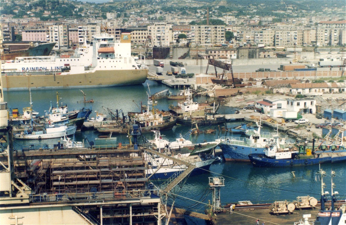
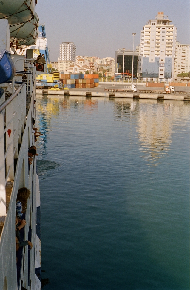
 Durres port seen from a ferry
References
- ^ http://www.apdurres.com.al/Financa/Business%20plan%202010%20DPA.pdf
- ^ "Port of Durrës". My new desk. http://www.mynewsdesk.com/se/view/pressrelease/albania-s-durres-port-authority-awards-a-five-year-service-contract-to-cargotec-285929.
- ^ "Albania's Durres port opens new passenger terminal". Setimes. http://www.setimes.com/cocoon/setimes/xhtml/en_GB/newsbriefs/setimes/newsbriefs/2010/08/18/nb-12.
- ^ "Additional info". nrlmry navy. http://www.nrlmry.navy.mil/~cannon/medports/Durres/index.html.
- ^ www.nrlmry.navy.mil "Additional info". nrlmry navy. http://www.nrlmry.navy.mil/~cannon/medports/Durres/index.html www.nrlmry.navy.mil.
- ^ "Port of Durrës". Seaport Homestead. http://seaport.homestead.com/files/durres.html.
- ^ "Durrës port". mynewsdesk. http://www.mynewsdesk.com/se/view/pressrelease/albania-s-durres-port-authority-awards-a-five-year-service-contract-to-cargotec-285929.
External links
Durrës Landmarks Villa of Ahmet Zogu · Durrës Archaeological Museum · Durrës Amphitheatre · Currilat · Beach of Durrës · Durrës Castle · Rodoni Castle · Durrës Library · Aleksander Moisiu Theatre · Estrada Theatre · St. Anthony Church · Fatih Mosque · The Beauty of Durrës · Adriatik Hotel · Aleksandër Moisiu University of DurrësEvents Media Shijak TVTransport Durrës Railway Station · Port of DurrësOil fields Categories:- Durrës
- Ports and harbours of Albania

Wikimedia Foundation. 2010.