Dürre Wand

Dürre Wand

The Dürre Wand (literally "barren wall") is a mountain ridge in Lower Austria and belongs topographically to the Gutenstein Alps. It runs from Miesenbach in a WSW direction to the Schneeberg. The Dürre Wand is a ridge, rocky in places, which is bordered by pastures, forests and waterfalls. In contrast to the plateau of the Hohe Wand immediately to the east, it culminates in a narrow edge, along which runs a path with outstanding views.

Contents

Elevations

The highest elevations are the Katharinenschlag (1,222 m AA), the Schober (1,213 m AA), the Öhler (1,183 m AA) and the Plattenstein (1,154 m AA).

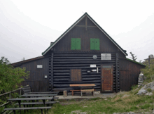
The Gauermann Hut in August 2007

Refuge huts

More or less in the centre of the ridge, east of the Öhler at a height of 1,027 m AA is the Öhler Refuge Hut which belongs to Friends of Nature (Naturfreunde). On the Plattenstein is the Gauermann Hut belonging to the Austrian Tourist Club (Österreichischer Touristenklub) or ÖTK.

Caves

The Tabler Cave east of the Plattenstein and the Erzloch, a shaft cave east of the Öhler refuge hut, are two caves on the crest of the Dürre Wand.

Gallery

External links

Coordinates: 47°49′59″N 15°55′17″E / 47.83306°N 15.92139°E / 47.83306; 15.92139


Wikimedia Foundation. 2010.

Игры ⚽ Нужна курсовая?

Look at other dictionaries:

  • Dürre Wand — Die Dürre Wand ist ein Höhenzug in Niederösterreich und gehört topografisch gesehen zu den Gutensteiner Alpen. Sie erstreckt sich von Miesenbach in Richtung WSW, hin bis zum Schneeberg. Die Dürre Wand ist ein teils felsendurchsetzter Bergkamm,… …   Deutsch Wikipedia

  • Schober (Dürre Wand) — Die Dürre Wand ist ein Höhenzug in Niederösterreich und gehört topografisch gesehen zu den Gutensteiner Alpen. Sie erstreckt sich von Miesenbach in Richtung WSW, hin bis zum Schneeberg. Die Dürre Wand ist ein teils felsendurchsetzter Bergkamm,… …   Deutsch Wikipedia

  • Hohe Wand (Bergmassiv) — pd1 Hohe Wand Der westliche Teil der Hohen Wand mit steil nach Süden abfallenden Felswänden. In der Bildmitte die Hochfallwand …   Deutsch Wikipedia

  • Naturpark Hohe Wand — 47.83416.048 Koordinaten: 47° 50′ 2,4″ N, 16° 2′ 52,8″ O …   Deutsch Wikipedia

  • Europaschutzgebiete Nordöstliche Randalpen — 47.88333333333315.983333333333 Koordinaten: 47° 53′ 0″ N, 15° 59′ 0″ O …   Deutsch Wikipedia

  • Katharinenschlag — Die Dürre Wand ist ein Höhenzug in Niederösterreich und gehört topografisch gesehen zu den Gutensteiner Alpen. Sie erstreckt sich von Miesenbach in Richtung WSW, hin bis zum Schneeberg. Die Dürre Wand ist ein teils felsendurchsetzter Bergkamm,… …   Deutsch Wikipedia

  • Liste der Landschaftsschutzgebiete in Niederösterreich — Kennzeichnung niederösterreichischer Landschaftsschutzgebiete In Niederösterreich gibt es 29 Landschaftsschutzgebiete, mit denen rund 22 Prozent der Fläche des Bundeslandes geschützt ist. Die Landschaftsschutzgebiete sind aufgrund des… …   Deutsch Wikipedia

  • Erzherzogtum Österreich unter der Enns — Niederösterreich Landesflagge Landeswappen …   Deutsch Wikipedia

  • N.Ö. — Niederösterreich Landesflagge Landeswappen …   Deutsch Wikipedia

  • Niederoesterreich — Niederösterreich Landesflagge Landeswappen …   Deutsch Wikipedia

Share the article and excerpts

Direct link
Do a right-click on the link above
and select “Copy Link”