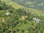
- Duradanda
-
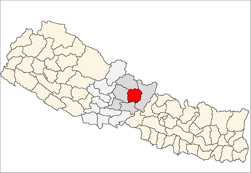
Duradanda — Village development committee — Location in Nepal
 Duradanda
Coordinates: 28°10′N 84°22′E / 28.16°N 84.37°ECoordinates: 28°10′N 84°22′E / 28.16°N 84.37°E Country  Nepal
NepalZone Gandaki Zone District Lamjung District Population (1991) - Total 2,135 Time zone Nepal Time (UTC+5:45) Duradanda is a village development committee in Lamjung District in the Gandaki Zone of northern-central Nepal. At the time of the 1991 Nepal census Facing east, it lies between river Kirenche in the east and Paudi river in the south ,Chadreswar Village in west .There is only high school named Sanskriti Sadan at village Archalyani .Duradanda had a population of 2135 people living in 430 individual households. It is three hour walk form the Sundarbazar.[1]
References
- ^ "Nepal Census 2001", Nepal's Village Development Committees (Digital Himalaya), http://www.digitalhimalaya.com/collections/nepalcensus/form.php?selection=1, retrieved 15 November 2009.
External links
Archalbot · Bahundanda · Bajhakhet · Balungpani · Bangre · Bansar · Bhalayakharka, Bharle, Bhoje · Bhorletar · Bhote Bazar · Bhujung · Bhulbhule · Bichaur · Chakratirtha · Chandisthan · Chandreshwor · Chiti · Dhamilikuwa · Dhodeni · Dhuseni · Dudhpokhari · Duradanda · Faleni · Gauda · Gaunsahar · Ghanpokhara · Ghermu · Gilung · Hiletaksar · Ilampokhari · Isaneshwor · Jita · Karapu · Khudi · Kolki · Kunchha · Maling · Mohoriyakot · Nalma · Nauthar · Neta · Pachok · Parewadada · Pasagaun · Puranokot · Pyarjung · Rangha, Samibhanjyang · Shree Bhanjyang · Simpani · Sindure · Sundarbazar · Suryapal · Taghring · Tandrang · Tarku · Tarkughat · Udipur · Uttarkanya
 Categories:
- Populated places in Lamjung District
- Gandaki Zone geography stubs


Wikimedia Foundation. 2010.