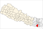
- Duhabi, Kosi
-
Duhabi, Kosi — Village development committee — Location in Nepal Coordinates: 26°35′N 87°17′E / 26.58°N 87.28°ECoordinates: 26°35′N 87°17′E / 26.58°N 87.28°E Country  Nepal
NepalZone Kosi Zone District Sunsari District Population (1991) – Total 11,286 Time zone Nepal Time (UTC+5:45) Duhabi, Kosi is a village development committee in Sunsari District in the Kosi Zone of south-eastern Nepal. At the time of the 2001 Nepal census it had a population of 17,574 people living in Duhabi.[1] Duhabi is situated in between Itahari and Biratnagar, in the bank of Budi river. It is the center of Sunsari-Morang Industrial corridor. The Industries around Duhabi are:
1) Jitendra Chamal and Tel Udhyog
2) Dhanlaxmi Synthetics
3) Arun Banaspati
4) Mainawati Steel industries
5) Rumpum
6) Mahalaxmi Maida mill
7) Pashupati Biscuits
8) Kwality Biscuits
9) Swastik oil
10) Bhagwati soap
11) Hulas wires and cables
12) Pioneer wires and cables
13) Premier wires and cables
14) Pashupati Iron
15) Pashupati Soap
16) Baba Biscuits
17) Arihant Multifibres
18) Shivam Plastic Ind. Pvt. Ltd. 19) Reliance Spinning Mills . etcReferences
- ^ "Nepal Census 2001". Nepal's Village Development Committees. Digital Himalaya. http://www.digitalhimalaya.com/collections/nepalcensus/output.php?selection=1. Retrieved 2 December 2008.
Aekamba, Amaduwa, Amahibelaha, Aurabarni, Babiya, Bakalauri, Barahachhetra, Basantapur, Bhadgau Sinawari, Bhaluwa, Bharaul, Bhokraha, Bishnupaduka, Chadwela, Chhitaha, Chimdi, Dewanganj, Dharan, Dhuskee, Duhabi, Dumaraha, Gautampur, Hanshpokha, Harinagar, Haripur, Itahari, Jalpapur, Kaptanganj, Khanar, Laukahi, Madhelee, Madhesa, Madhuwan, Madhyeharsahi, Mahendranagar, Narshinhatappu, Pakali, Panchakanya, Paschim Kasuha, Prakashpur, Purbakushaha, Ramganj Belgachhi, Ramganj Senuwari, Ramnagar Bhutaha, Sahebganj, Santerjhora, Simariya, Singiya, Sonapur, Sripurjabdi, Tanamuna Categories:
- Populated places in Sunsari District
- Kosi Zone geography stubs
Wikimedia Foundation. 2010.

