- Dugdale Glacier
-
Dugdale Glacier (71°38′S 169°50′E / 71.633°S 169.833°E) is a glacier about 46 km long, draining northeast from the Admiralty Mountains into Robertson Bay on the north coast of Victoria Land. It flows along the west side of Geikie Ridge before coalescing with Murray Glacier just west of Duke of York Island. Charted by British Antarctic Expedition 1898-1900, under Carsten Borchgrevink, who named it for Frank Dugdale of Snitterfield, Stratford-on-Avon.
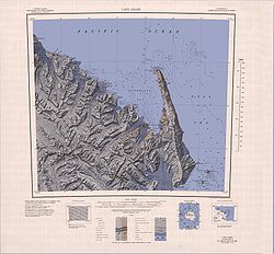 The Dugdale Glacier is located just below the centre of this map
 This article incorporates public domain material from the United States Geological Survey document "Dugdale Glacier" (content from the Geographic Names Information System).
This Victoria Land location article is a stub. You can help Wikipedia by expanding it.
