- Draper Site, Wendat (Huron) Ancestral Village
-
Draper Site Location 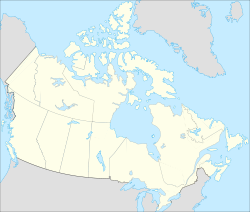

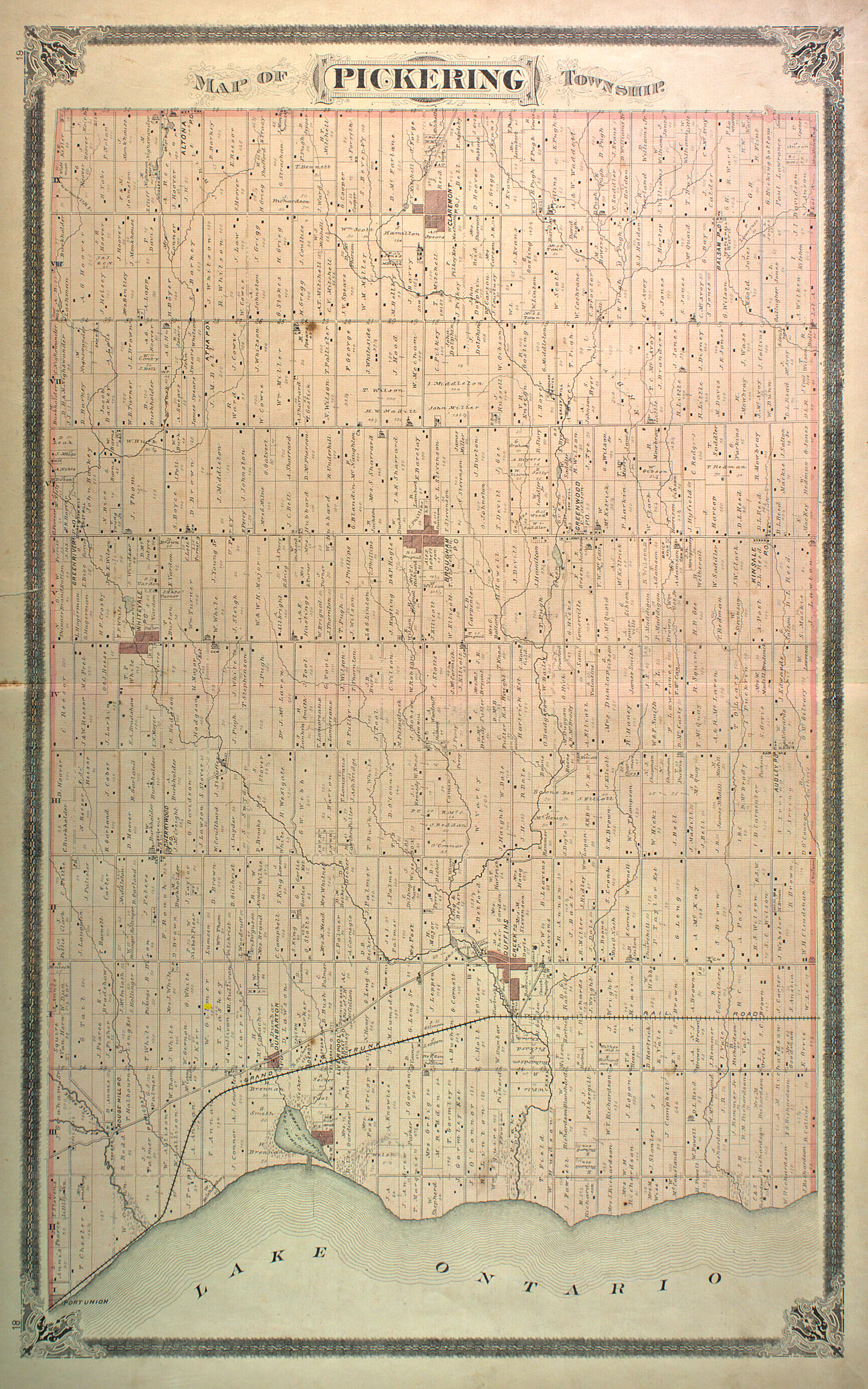
Coordinates 43°55′42″N 79°10′32″W / 43.92833°N 79.17556°WCoordinates: 43°55′42″N 79°10′32″W / 43.92833°N 79.17556°W Culture Huron (Wendat) Period Late Precontact Period, ca. 1475-1525 Country Canada Region Pickering, Ontario, Regional Municipality of Durham, Ontario Elevation 222 m (728 ft) The Draper Site is a Precontact period (late fifteenth-century) Huron-Wendat ancestral village located on a tributary of West Duffins Creek in present-day Pickering, Ontario, approximately 35 kilometres north-east of Toronto.[1]
The Huron community on the Draper site expanded at least five times over fifty years, with a total of 35 longhouses that held up to 2000 people. They were located on four hectares of land and the settlement was fortified with multiple rows of palisades.[2] The expansion of the village coincided with the abandonment of small villages in the area.[3] In the early sixteenth-century, after about a generation on the Draper site, the entire community moved five kilometres north-west to establish a new settlement, which archeologists have named the Mantle Site. The latter is located in the south-east corner of present-day Stouffville.[4] The same community appears to have left the Mantle site circa 1550 to establish the so-called Ratcliff site and the Aurora or Old Fort site to the north-west in what is today the Town of Whitchurch-Stouffville.
In early 1975 and 1978, the largely undisturbed Draper Huron village site was completely excavated. This archeological work was to explore and salvage artifacts and evidence in preparation for the destruction of the site during the construction of the Pickering Airport.[5]
Further reading
- Birch, Jennifer. "Rethinking the Archeological Application of Iroquoian Kinship", Canadian Journal of Archeology 32 (2008), 194–213.
- Birch, Jennifer. "Coalescence and Conflict in Iroquoian Ontario." Archeological Review from Cambridge 25, no. 1 (2010), 29–48.
- Bowman, Irene. "The Draper Site: White Pine Succession on an Abandoned Late Prehistoric Iroquoian Maize Field." North Pickering Archeaology, Part II (1974), 54-85.
- Dodd, Christine F. "Ontario Iroquois Tradition Longhouses." M.A. Thesis, Simon Fraser University. Burnaby, BC, 1982. (Search "Draper").
- Finlayson, William D. The 1975 and 1978 Rescue Excavations at the Draper Site: Introductions and Settlements. Ottawa: National Museum of Man, 1985.
- Hayden, Brian, ed. Settlement Patterns of the Draper and White Sites: 1973 Excavations. Burnaby, BC: Archaeology Press Simon Fraser University, 1979.
- Sioui, Georges E. Wendat: The Heritage of the Circle. Trans. J. Brierley. Vancouver, BC: UBC Press, 1999.
- Trigger, Bruce G. Natives and Newcomers: Canada's Heroic Age Reconsidered. Montreal: McGill-Queen's University Press, 1985. Pp. 72, 101, 103, 151, 215, 220.
- Warrick, Gary A. "Reconstructing Ontario Iroquoian Village Organization," M.A. Thesis, Simon Fraser University. Burnaby, BC, 1983.
- Warrick, Gary A. "A Population History of the Huron-Petun, A.D. 900-1650," PhD Thesis, McGill University. Montreal, PQ, 1990 (revised edition published as A Population History of the Huron-Petun, A.D. 500-1650. New York: Cambridge University Press, 2008).
- Warrick, Gary A. "The Precontact Iroquoian Occupation of Southern Ontario." In Jorden E. Kerber, ed., Archaeology of the Iroquois: selected readings and research sources, ch. 7, pp. 124–164. Syracuse, NY: Syracuse University Press, 2007.
- Williamson, Ronald. ""'Otinontsiskiaj ondoan (The House of Cut-off Heads): The History and Archaeology of Northern Iroquoian Trophy Taking." In The Taking and Displaying of Human Body Parts as Trophies by Amerindians, 190-221. Ed. Richard J. Chacon and David H. Dye. New York: Springer, 2007 (esp. pp 210–212).
External links
- The Huron-Wendat Museum, Wendake, Quebec
- Huron-Wendat Nation, Wendake, Quebec.
- Agondachia Association, Ossossane Fondation, Wendake, Quebec
References
- ^ See the 1877 map of Pickering Township. Lots 29 and 30, Concession VII (lot owners: William H. Burk and Adam Spears), Historical Atlas of Ontario County. Today, the site is south-east of the train tracks, off Concession 7. Its identifying code is A1Gt-2.
- ^ See an artist's reconstruction of the Draper village at its largest: [1].
- ^ Jennifer Birch, "Coalescence and Conflict in Iroquoian Ontario," Archeological Review from Cambridge 25, no. 1 (2010), 37; see also K. Bolander, Million Pieces Turned Up, Stouffville Sun-Tribune, Aug 24, 1978, p. 1.
- ^ K. Bolander, Million Pieces Turned Up, Stouffville Sun-Tribune, Aug 24, 1978, p. 1.
- ^ "Slower pace at Draper Site: rescue technique not needed," Stouffville Sun-Tribune, October 9, 1975, 5.
Categories:- Pickering, Ontario
- Iroquois populated places
- Archaeological sites in Canada
- First Nations history in Ontario
- Wyandot people

![[1]](http://www.pada.ca/lib/images/2/4496.jpg)
Wikimedia Foundation. 2010.