- Derazhne
-
Derazhne
Деражне— Village — 
Flag
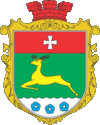
Coat of armsLocation within the Rivne Oblast Coordinates: 50°51′44″N 26°02′58″E / 50.86222°N 26.04944°ECoordinates: 50°51′44″N 26°02′58″E / 50.86222°N 26.04944°E Country  Ukraine
Oblast Rivne Oblast Raion Kostopil Raion Silska Rada Derazhne Silska Rada Founded 1274 Area - Total 4.87 km2 (1.9 sq mi) Elevation 175 m (574 ft) Population (2001) - Total 2,102 - Density 431.36/km2 (1,117.2/sq mi) Time zone EET (UTC+2) - Summer (DST) EEST (UTC+3) Postal code (Index) 35053 Area code(s) +380 3657 Derazhne (Ukrainian: Деражне) is a village in Kostopil Raion, Rivne Oblast, Ukraine. As of the year 2001, the community had 2102 residents. Postal code — 35053.[1] KOATUU code — 5623481601.
References
- ^ Registration card on the website of the Verkhovna Rada of Ukraine (Ukrainian)
External links
- Article Derażne in the Geographical Dictionary of the Kingdom of Poland, Volume I (Aa — Dereneczna), 1880 year
 (Polish)
 - The activities in the Bandera area Dera (Polish)
- Weather in the Derazhne (Ukrainian)
Categories:- Rivne Oblast
- Villages in Ukraine
Wikimedia Foundation. 2010.

