Deadman SSSI, Somerset — Deadman Site of Special Scientific Interest … Wikipedia
Dead woman — may refer to: Geography Dead Woman s Pass, a mountain pass in the Andes Dead Woman Hills, Caddo County, Oklahoma Dead Woman s Hill, a hill near Sandridge, Hertfordshire, England Dead Woman s Hill, a hill located opposite Deadman s Hill near… … Wikipedia
Dead Man's Curve (song) — For other uses, see Dead Man s Curve (disambiguation). Dead Man s Curve Single by Jan and Dean from the album … Wikipedia
2009 MuchMusic Video Awards — Logo Format Awards show Starring Leah Miller, Tim Deegan, Sarah Taylor … Wikipedia
List of songs about California — TOC California* All of California and Everyone Who Lives There Stinks by The World/Inferno Friendship Society * All the Gold in California by The Gatlin Brothers * Antennas by Rancid * Atomic by Tiger Army * Away from California by Radio Racer *… … Wikipedia
List of DC Comics publications — This literature related list is incomplete; you can help by expanding it. DC Comics is one of the largest comic book and graphic novel publishers in North America. DC has published comic books under a number of different imprints and corporate… … Wikipedia
Mötley Crüe — de izquierda a derecha: Nikki Sixx, Tommy Lee, Mick Mars, y Vince Neil. Datos generales … Wikipedia Español
Mono–Inyo Craters — Coordinates: 37°53′N 119°0′W / 37.883°N 119°W / 37.883; 119 … Wikipedia
Bonaparte Plateau — The Bonaparte Plateau is a subarea of the larger Cariboo Plateau, which extends to the Quesnel River and lies between the Cariboo Mountains on the east and the Fraser River on the west. The Cariboo Plateau is a subarea of the Interior Plateau,… … Wikipedia
John Day Fossil Beds National Monument — Coordinates: 44°33′21″N 119°38′43″W / 44.55583°N 119.64528°W / 44.55583; 119.64528 … Wikipedia
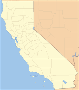
 location of Deadman Hills in California [1]