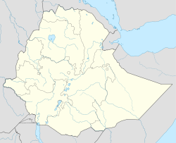
- Dabat
-
Dabat Location within Ethiopia Coordinates: 12°59′03″N 37°45′54″E / 12.98417°N 37.765°E Country  Ethiopia
Region Amhara Zone Semien Gondar Zone Elevation 2,596 m (8,517 ft) Population (2007) – Total 12,574 Time zone EAT (UTC+3) Dabat is a town in northern Ethiopia. Located on the Semien Mountains along the Gondar-Debarq highway[1] it is in the Semien Gondar Zone of the Amhara Region. Dabat is one of two towns in Dabat woreda.
There is a state run health centre in Dabat.[2]
Demographics
According to the 2007 national census, this town has a total population of 12,574 of whom 5,662 are men and 6,912 are women.[3] The 1994 census reported Dabat had a total population of 8,782 of whom 3,737 were men and 5,045 were women.[4]
Notes
- ^ Ethiopian Roads Authority, Gondar-Debark Road Project: Review of Environmental Impact Assessment, February 2007, p. 32
- ^ Staff (11 May 2004) "UNICEF Funds Medical University Training for Treatment of Severe Acute Malnutrition" United Nations Children’s Fund, Addis Ababa, Ethiopia; accessed 12 September 2010
- ^ Census 2007 Tables, Table 2.2 Population of Towns by Sex: 2007. Central Statistical Agency website
- ^ 1994 Population and Housing Census of Ethiopia: Results for Amhara Region, Vol. 1, part 1, Table 2.1, accessed 12 September 2010
Categories:- Populated places in the Amhara Region
- Amhara geography stubs
Wikimedia Foundation. 2010.

