- Sam Mbakwe Airport
-
Sam Mbakwe International Cargo Airport
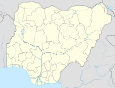
Imo AirportIATA: QOW – ICAO: DNIM Location of airport in Nigeria Summary Airport type Public Owner/Operator Federal Airports Authority of Nigeria (FAAN) Serves Owerri, Nigeria Elevation AMSL 373 ft / 114 m Coordinates 05°25′37″N 007°12′21″E / 5.42694°N 7.20583°E Runways Direction Length Surface m ft 17/35 2,700 8,858 Asphalt FAAN[1] and DAFIF[2][3] Sam Mbakwe International Cargo Airport[1] (IATA: QOW[3], ICAO: DNIM), also known as Imo State Airport[2], is an airport serving Owerri, the capital city of Imo State in southern-eastern Nigeria. The airport is named in honor of a former governor and politician-philanthropist, the late Chief Sam Mbakwe of Imo State.
Contents
Facilities
The airport resides at an elevation of 373 feet (114 m) above mean sea level. It has one runway designated 17/35 with an asphalt surface measuring 2,700 metres (8,900 ft) by 45 metres (148 ft).[2]
Airlines and destinations
Airlines Destinations Aero Contractors Lagos Air Nigeria Abuja, Lagos Arik Air Abuja, Lagos References
- ^ a b "Sam Mbakwe Airport - Owerri". Federal Airports Authority of Nigeria. http://www.faannigeria.org/nigeria-airport.php?airport=17. Retrieved 24 April 2010.
- ^ a b c Airport information for DNIM from DAFIF (effective October 2006)
- ^ a b Airport information for QOW at Great Circle Mapper. Source: DAFIF (effective Oct. 2006).
External links
Categories:- Airports in Nigeria
- Imo State
Wikimedia Foundation. 2010.

