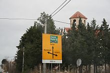
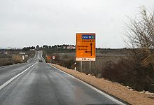
- D502 road (Croatia)
-
D502 state road Route information Length: 16.4 km (10.2 mi) Major junctions From:  D27 in Karin
 D56 in Smilčić
 D424 near Zemunik Gornji
To: Zemunik Donji Location Counties: Zadar Highway system State roads in Croatia
D502 is a state road connecting D27 state road and the D424 expressway Tromilja interchange to a number of settlements in Zadar hinterland and A1 motorway Zadar 2 interchange (via D424).[1] The road is 16.4 km (10.2 mi) long.[2]
D502 is a connecting route providing a bypass of A1 motorway Maslenica Bridge and D8 state road Maslenica Bridge in case of strong winds.
Originally the road extended to Zadar itself, however in April 2010, the road was shortened in order to cancel the existing intersection with the Zadar Airport runway. The intersection used to be guarded by traffic signs and barriers similar to the ones found near at-grade railroad crossings.[3]
The road, as well as all other state roads in Croatia, is managed and maintained by Hrvatske ceste, state owned company.[4]
Contents
Traffic volume
Traffic is regularly counted and reported by Hrvatske ceste, operator of the road.[5] Substantial variations between annual (AADT) and summer (ASDT) traffic volumes are attributed to the fact that the road carries substantial tourist traffic in Zadar area.
D502 traffic volume Road Counting site AADT ASDT Notes  D502
D5024924 Smilčić east 2,205 3,191 Between Ž6019 and Ž6023 junctions. Road junctions and populated areas
D502 junctions/populated areas Type Slip roads/Notes 
Karin
 D27 to Gračac and Benkovac. The northern terminus of the road.
Ž6019 to Pridraga, Novigrad and Posedarje 
Smilčić
 D56 to Benkovac.
Ž6023 to Gornje Biljane.
Zemunik Gornji 
 D424 expressway in Tromilja interchange - providing access to Zadar and A1 motorway Zadar 2 interchange.[1]
Zemunik Donji
The southern terminus of the road.Sources
- ^ a b "Regulation on motorway markings, chainage, interchange/exit/rest area numbers and names" (in Croatian). Narodne novine. May 6, 2003. http://narodne-novine.nn.hr/clanci/sluzbeni/305463.html.
- ^ "Decision on categorization of public roads as state roads, county roads and local roads" (in Croatian). Narodne novine. February 17, 2010. http://narodne-novine.nn.hr/clanci/sluzbeni/2010_02_17_410.html.
- ^ "Intersection of a road and a runway set to become a part of history" (in Croatian). Večernji list. April 2, 2010. http://www.vecernji.hr/regije/raskrizje-avionske-piste-ceste-srijedu-ipak-postaje-povijest-clanak-119886.
- ^ "Public Roads Act" (in Croatian). Narodne novine. December 14, 2004. http://narodne-novine.nn.hr/clanci/sluzbeni/2004_12_180_3130.html.
- ^ "Traffic counting on the roadways of Croatia in 2009 - digest" (in English). Hrvatske ceste. May 1, 2010. http://www.hrvatske-ceste.hr/WEB%20-%20Legislativa/brojenje-prometa/CroDig2009.pdf.
See also
- State roads in Croatia
- Hrvatske ceste
Categories:- State roads in Croatia
- Zadar County
Wikimedia Foundation. 2010.


