- Cupey, San Juan, Puerto Rico
-
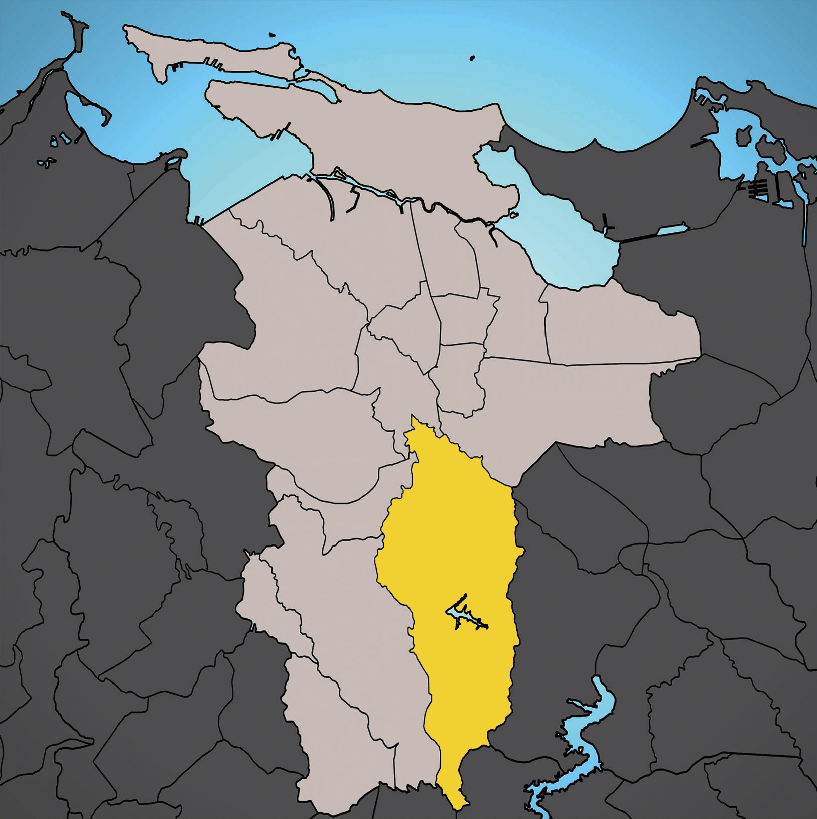
Barrio of Cupey Location of Cupey shown in yellow.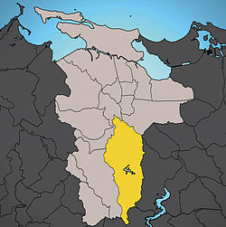
Country  United States
Territory  Puerto Rico
Municipality San Juan Area - Total 7.55 sq mi (19.55 km2) - Land 7.49 sq mi (19.40 km2) - Water 0.06 sq mi (0.16 km2) Population (2000) - Total 36,659 - Density 4,897.6/sq mi (1,890.97/km2) 2000 census Main article: San Juan, Puerto RicoCupey is the largest barrio in the municipality of San Juan, and the third most populous with 36,659 inhabitants according to Census 2000. The territorial land area of Cupey is 7.49 square miles (19.40 km²). It is bound by the municipality of Caguas to the South, by the municipality of Trujillo Alto to the East, by the barrios of Caimito and Monacillo to the West, and by the barrios of El Cinco and Sabana Llana Sur to the North. Between 1990 and 2000 Cupey experienced a 17.98% in population growth making it the biggest population gainer of any barrio in San Juan.
History
The ward of Cupey was a former ward of the disappeared town of Rio Piedras, and was divided by the wards of Cupey Alto (Cupey Upward) and Cupey Bajo (Cupey Downward). In 1956, the Puerto Rico Legislature integated the town of Rio Piedras to the town of San Juan. Today, Cupey is the biggest ward in San Juan in territorial terms.
Geography
The Cupey ward is 7.49 square miles (19.40 km²). Its bound to the nort by the San Juan wards of El Cinco along State Road PR-176, and by Sabana Llana Sur in the Venus Gardens neighborhood. Form the south is bound by the town of Caguas starting in the itersection of state roads PR-176 and PR-175. From the east is bound by the town of Trujillo Alto along state road PR-199. From the west is bound by the San Juan wards of Caimito, starting at the intersection of state road PR-199 and state highway PR-52, and by Monacillo starting in the intersection of state road PR-1 and state highway PR-52. Its population in 2000 was 36,659. Its compose by many neighborhoods, these are:
- El Señorial
- Rivieras de Cupey
- Segunda Unidad
- Litheda Heights
- Antigua Via
- Venus Gardens Norte
- Venus Gardens Oeste
- Venus Gardens Sur
- El Paraiso Neighborhood
- El Dorado Neighborhood
- Rio Piedras Heights
- Crown Hills
- San Gerardo Village
- San Claudio Village
- Cupey Gardens
- Cupey Bajo
- Los Choferes
- Alturas de Cupey
- Fair View
- Las Curias
- Los Paseos
Coordinates: 18°20′46″N 66°02′55″W / 18.34611°N 66.04861°W
Categories:- Río Piedras, Puerto Rico
- Districts of San Juan, Puerto Rico
Wikimedia Foundation. 2010.