- Colquhoun railway station
-
Colquhoun Station information Line Orbost Distance from Southern Cross 321.410 km Number of platforms 1 Number of tracks 1 Station status Closed Station opened 1916 Station closed 1987 Colquhoun Railway Station was opened on Monday 10 April 1916 as part of the Orbost railway line. The station has long since closed, with the last train passing the site in 1987.[1]
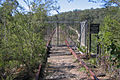
Little evidence remains of the former station site, however the site remains as part of the East Gippsland Rail Trail, which follows the route of the former rail line.[2]
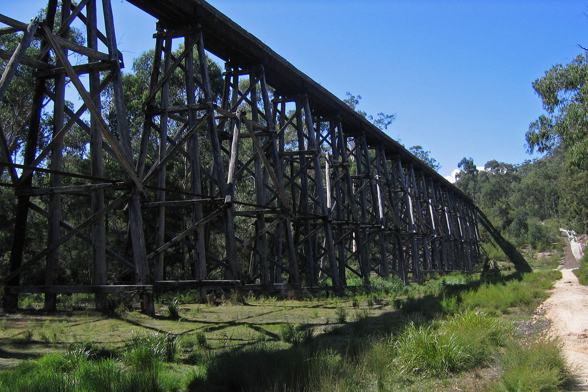
To the east of the former station site, about 4.5 km west of Nowa Nowa is the spectacular Stony Creek Trestle Bridge, built in the early 1900s and measuring 276m long and 19m high. While the bridge remains largely intact, including rails, for safety reasons due to its poor condition the bridge itself is fenced off, and the rail trail deviates down and across the Stony Creek valley beside the bridge. A carpark, toilet and picnic facilities are available at this location.[2]
Gallery
-
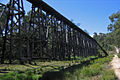
Stony Creek trestle looking east from below bridge
-
Stony Creek Trestle Bridge looking east along the bridge deck
References
- ^ "Colquhoun". Victorian Railway Stations. http://www.vicrailstations.com/Orbost/Colquhoun/Colquhoun.html. Retrieved 2009-11-04.
- ^ a b "East Gippsland Rail Trail - Trail Notes: EGRT/Section 3:16 - 22". East Gippsland Rail Trail Official Site. 2009-01-12. http://eastgippslandrailtrail.com/trailnotes/EGRTSection3.pdf. Retrieved 2009-04-30.
Station navigation Orbost line ← Previous station Bruthen | Nowa Nowa Next station → Closed stations Coordinates: 37°44′35″S 148°2′34″E / 37.74306°S 148.04278°E
Categories:- Disused railway stations in Victoria (Australia)
- Victoria (Australia) rail transport stubs
-

Wikimedia Foundation. 2010.