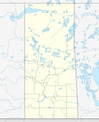
Saskatchewan Highway 965 — Highway 965 is a highway in the Canadian province of Saskatchewan. It runs from Highway 903 to Highway 155. Highway 965 is about 28 km (17 mi.) long.Highway 965 also intersects the Cole Bay Access Road and the Canoe Narrows Access Road. It passes … Wikipedia
Saskatchewan Highway 16 — Infobox road marker province=SK name notes=Provincial Highway 5 and 14 (historic) type=Hwy route=16 alternate name=Yellowhead Trans Canada Highway maint=Ministry of Highways and Infrastructure Transport Canada length km=699.08 length round=2… … Wikipedia
List of communities in Saskatchewan — Communities of the Province of Saskatchewan, Canada are incorporated towns, cities, villages, and resort villages and unincorporated organized hamlets.[1] Regional rural forms of administration are rural municipalities.[clarification needed]… … Wikipedia
Comunidades en Saskatchewan — Las Comunidades de la provincia de Saskatchewan, Canadá son todas las villas, ciudades, pueblos, incorporados, villas turísticas y aldeas organizadas no incorporadas.[1] Las formas rurales regionales de administración son municipalidades… … Wikipedia Español
Provincial roads in northern Saskatchewan — In the northern part of the Canadian province of Saskatchewan, Saskatchewan Highways and Transportation maintains a network of provincial roads numbered in the 900s as opposed to the provincial highways with numbers under 400 that provide access… … Wikipedia
List of Saskatchewan provincial highways — This is a list of Saskatchewan s highways:Only Highways 1, 2, 6, 7, 11, 12, and 16 contain sections of divided highway. Speed limits range from 90 km/h (55 mph) to 110 km/h (70 mph). Saskatchewan is the only province bordering the United States… … Wikipedia
List of Indian reserves in Saskatchewan — List of Indian Reserves in Saskatchewan, CanadaSee also: list of rural municipalities in Saskatchewan, Canada See also: List of communities in Saskatchewan, CanadaA*Atahkakoop First Nation *Aquadeo *Ahtahkakoop 104 *Assiniboine 76B*Beardy s… … Wikipedia
Simpson, Saskatchewan — Infobox Settlement settlement type = official name = Simpson nickname = motto = imagesize = image caption = image mapsize = map caption = mapsize1 = map caption1 = pushpin latd=51.45|longd= 105.45 subdivision type = Country subdivision type1 =… … Wikipedia
List of Aboriginal communities in Canada — The following is a list of Aboriginal communities in Canada. While communities for all Aboriginal peoples in Canada (the First Nations, Inuit, and Métis) are included, the list is largely made up of Indian reserves, which are sometimes… … Wikipedia
Canoe (disambiguation) — A canoe is a narrow human powered boat. It may also refer to canoe style watercraft, including: * in many European countries, the word Canoe often refers to a kayak * Outrigger canoe, a type of canoe featuring one or more lateral support floats… … Wikipedia

