- Ciudad del Plata
-
Ciudad del Plata — City — Location in Uruguay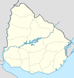
 Ciudad del Plata
Coordinates: 34°46′0″S 56°22′50″W / 34.766667°S 56.38056°WCoordinates: 34°46′0″S 56°22′50″W / 34.766667°S 56.38056°W Country  Uruguay
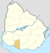
Department San José Department Population (2009) - Total 35,588 Time zone UTC -3 Postal code 80101 Area code(s) +598 2 (+7 digits) Ciudad del Plata is a city in San José Department of Uruguay. It is delimited by Santa Lucía River to the east and to the north, the Río de la Plata to the south and the 35th kilometre of the Route 1 also named "Brigadier General Manuel Oribe". Its population in 2009 was 35,588 inhabitants. It has a big concentration of industries.
Contents
History
The whereabouts of Ciudad del Plata were formerly known as Rincón de la Bolsa. It was a group of independent fragments, which became integrated into one populated centre, as a result of the westward expansion of the metropolitan area of Montevideo.
According to the legislative decree nº18.052, it received city status under the name 'Ciudad del Plata' on 25 October 2006.[1] The former fragments became barrios (neighbourhoods) of the newly formed city.
Barrios
The barrios of Ciudad del Plata are: Delta del Tigre, Sofima, Villa Rives, San Fernando, Parque Postel, Autódromo Nacional, San Fernando Chico, Parque del Plata, Monte Grande, Safici, Las Violetas, Penino, Santa Mónica, Santa María, Santa Victoria, San Luis, Playa Pascual, Villa Olímpica.
The populations of the biggest of these centres up to the census of 2004[2] were as follows:
Delta del Tigre y Villas Monte Grande Safici Villa María Year Population 1963 3,474 1975 8,831 1985 9,618 1996 14,120 2004 17,457 Year Population 1963 - 1975 - 1985 352 1996 710 2004 1,084 Year Population 1963 - 1975 - 1985 502 1996 656 2004 948 Year Population 1963 104 1975 209 1985 279 1996 322 2004 512 Source: Instituto Nacional de Estadística de Uruguay[3][4][5][6]
References
- ^ "LEY N° 18.052". República Oriental del Uruguay, Poder Legislativo. 1963. http://www.parlamento.gub.uy/leyes/AccesoTextoLey.asp?Ley=18052&Anchor=. Retrieved 28 June 2011.
- ^ "2004 Census of San José department" (XLS). INE. 2004. http://www.ine.gub.uy/fase1new/Sanjose/Cuadro7_16.XLS. Retrieved 28 June 2011.
- ^ "1963–1996 Statistics / D" (DOC). Instituto Nacional de Estadística de Uruguay. 2004. http://www.ine.gub.uy/biblioteca/toponimico/TOPOletraD.doc. Retrieved 27 June 2011.
- ^ "1963–1996 Statistics / M" (DOC). Instituto Nacional de Estadística de Uruguay. 2004. http://www.ine.gub.uy/biblioteca/toponimico/TOPOletraM.doc. Retrieved 27 June 2011.
- ^ "1963–1996 Statistics / S" (DOC). Instituto Nacional de Estadística de Uruguay. 2004. http://www.ine.gub.uy/biblioteca/toponimico/TOPOletraS.doc. Retrieved 27 June 2011.
- ^ "1963–1996 Statistics / V" (DOC). Instituto Nacional de Estadística de Uruguay. 2004. http://www.ine.gub.uy/biblioteca/toponimico/TOPOletraV.doc. Retrieved 27 June 2011.
External links
- Official site of Ciudad del Plata
- Map of Ciudad del Plata (3.3MB)
- INE map of Delta del Tigre, Safici & Monte Grande
- INE map of Villa María
- INE map of Playa Pascual & Santa Mónica
Coast_of_  Coast of San José Department
Resorts
and
LandformsCiudad del Plata (Playa Pasqual) • (Punta del Tigre, Barrancas de Mauricio) • Kiyú - Ordeig • (Punta de San Gregório, Punta Jesús María, Playa Sánchez, Playa Arazatí, Puerto Arazatí) • Bocas del Cufré (Gran Playa Bocas del Cufré)
Glossary : Playa = Beach , Puerto = Port , Punta (or Pta) = Point, Small Peninsula San José Department of UruguayCapital: San José de Mayo Towns and
villagesCapurro • Ciudad del Plata • Delta del Tigre y Villas * • Ecilda Paullier • Ituzaingó • Libertad • Monte Grande • Ordeig • Playa Pascual * • Puntas de Valdez • Rafael Perazza • Raigón • Rodríguez • Safici • San José de Mayo • Santa Mónica * • Villa María * – (* parts of Ciudad del Plata as of 2006)
Sights Categories:- Uruguay geography stubs
- Populated places in the San José Department
- Populated places established in 2006


Wikimedia Foundation. 2010.