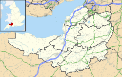
- Church of St Peter and St Paul, Shepton Mallet
-
Church of St Peter and St Paul 
General information Town or city Shepton Mallet Country England Coordinates 51°11′28″N 2°32′45″W / 51.1910°N 2.5457°W Completed 15th century The Church of St Peter and St Paul in Shepton Mallet, Somerset, England dates from the 12th century and has been designated as a Grade I listed building.[1]
There is evidence of a church on the site from before the Norman Conquest and the font may date from that time. The only other remains are the walls around the chancel arch.[2]
The current building is largely from the 15th century, with further rebuilding in 1836 to 1837 when the chapels, aisles and transepts were demolished in order to enlarge them.[2] The timber roof includes 350 panels of different designs and 36 carved angels along the sides, which was described by Nikolaus Pevsner as "the finest 15th century carved oak wagon-roof in England".[3] The stone pulpit dates from around 1550 and has six carved panels.[2]
The four stage tower was built around 1423, with four pinnacles, a lozenge parapet, triple window arrangement and stair turret.[4] It was originally intended to have a spire but this was never built.[5]
The Millennium Window (2000 AD) was designed, constructed and installed by local stained glass artist John Yeo.[6]
See also
- List of Grade I listed buildings in Mendip
- List of towers in Somerset
References
- ^ "Church of St Peter & St Paul". Images of England. http://www.imagesofengland.org.uk/Details/Default.aspx?id=266464. Retrieved 2008-03-02.
- ^ a b c Robinson, W.J. (1915). West Country Churches. Bristol: Bristol Times and Mirror Ltd. pp. 144–149.
- ^ Leete-Hodge, Lornie (1985). Curiosities of Somerset. Bodmin: Bossiney Books. pp. 20. ISBN 0906456983.
- ^ Poyntz Wright, Peter (1981). The Parish Church Towers of Somerset, Their construction, craftsmanship and chronology 1350 - 1550. Avebury Publishing Company. ISBN 0861275020.
- ^ Bush, Robin (1994). Somerset: The Complete Guide. Wimborne: Dovecote Press. pp. 179–181. ISBN 1874336261.
- ^ "The Historic St Peter and St Paul". St Peter and St Pauls Parish Church. http://www.mediaconcepts.co.uk/peterpaul/church.shtml. Retrieved 3 February 2011.
Categories:- 15th-century architecture
- Grade I listed churches
- Grade I listed buildings in Somerset
- Church of England churches in Mendip
Wikimedia Foundation. 2010.

