- Church of St. Peter, Langford Budville
-
Church of St. Peter 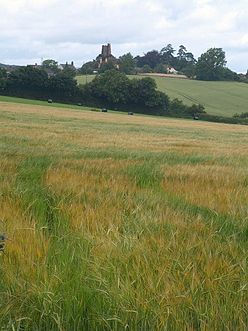
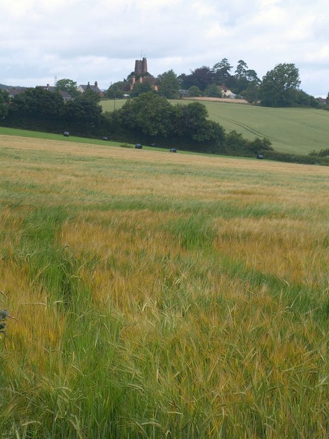
The church tower seen across fields from the south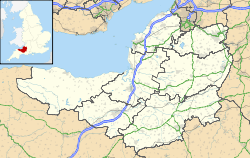
 Location within Somerset
General information Town or city Langford Budville Country England Coordinates 50°59′56″N 3°16′01″W / 50.9988°N 3.2669°W Completed 15th century The Church of St. Peter in Langford Budville, Somerset, England dates from the 15th century and has been designated as a Grade I listed building.[1]
The red sandstone church has the capacity for about 150 people,[2] including the north aisle which was added in 1866 to accommodate worshippers from Binden House.[3]
The tower was added in the early 16th century[4] and the south aisle soon afterwards. The church was restored in 1846 and the north aisle added in 1866. The vestry and organ chamber were added in 1873.[1] The tower holds five bells which were re-hung as part of the refurbishment in the 1990s,[2] which also included repairs to the roof and stonework.[5] There is a War Memorial in the form of a brass plaque.[6]
Until 1863 Langford Budville was a chapelry of Milverton, and in 1930 Runnington was united with the benefice.[1]
The parish is within the Wellington and district benefice which is part of the Tone deanery.[7]
See also
- List of Grade I listed buildings in Taunton Deane
- List of towers in Somerset
References
- ^ a b c "Church of St Peter". Images of England. http://www.imagesofengland.org.uk/details/default.aspx?id=270981. Retrieved 6 December 2007.
- ^ a b "St Peter, Langford Budville". Wellington and district team ministry. http://www.wellingtonteamchurches.org.uk/langfordBudvilleChurch.html. Retrieved 4 October 2011.
- ^ "History". Langford Budville. http://www.langfordbudville.org/history.html. Retrieved 4 October 2011.
- ^ Poyntz Wright, Peter (1981). The Parish Church Towers of Somerset, Their construction, craftsmanship and chronology 1350 - 1550. Avebury Publishing Company. ISBN 0861275020.
- ^ "Previous Projects". Robert Glynwoods & Andrew Plint, Stone & Building Conservation. http://www.stonemasonrysomerset.co.uk/projects.htm. Retrieved 4 October 2011.
- ^ "Langford Budville war memorial". Roll of Honour. http://www.roll-of-honour.com/Somerset/LangfordBudville.html. Retrieved 4 October 2011.
- ^ "St Peter, Langford Budville". Church of England. http://www.achurchnearyou.com/langford-budville-st-peter/. Retrieved 4 October 2011.
Categories:- Church of England churches in Somerset
- 15th-century architecture
- Grade I listed churches
- Grade I listed buildings in Somerset
- Taunton Deane

Wikimedia Foundation. 2010.