- Church of All Saints, West Camel
-
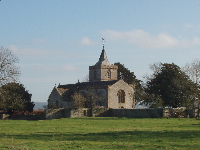
Church of All Saints 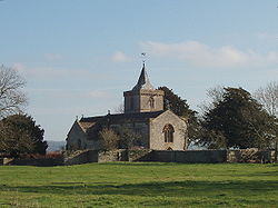
Location: West Camel, Somerset, England Coordinates: 51°01′06″N 2°35′53″W / 51.01833°N 2.59806°WCoordinates: 51°01′06″N 2°35′53″W / 51.01833°N 2.59806°W Built: 14th century Listed Building – Grade I Designated: 19 April 1961[1] Reference #: 262745 
 Location of Church of All Saints in Somerset
The Church of All Saints in West Camel, Somerset, England dates from the late 14th century and has been designated as a Grade I listed building.[1]
There had been a previous wooden church on the site since 995 until around 1100 when it was replaced by a small stone Norman church, which was added to over subsequent centuries.[2] The first church may have been founded by Muchelney Abbey.[3]
The tie-beam roof of the nave dates from the 15th century.[3] The tower holds six bells the oldest of which was cast in the 15th century.[2] The church underwent extensive Victorian restoration in the 1860s.[3]
The parish is part of the Cam Vale benefice within the Bruton and Cary deanery.[4]
See also
- List of Grade I listed buildings in South Somerset
- List of towers in Somerset
References
- ^ a b "Church of All Saints". Images of England. English Heritage. http://www.imagesofengland.org.uk/Details/Default.aspx?id=262745. Retrieved 21 June 2009.
- ^ a b "Churches". West Camel. http://www.westcamel.org.uk/churches.htm. Retrieved 18 November 2011.
- ^ a b c R. W. Dunning (editor), A. P. Baggs, R. J. E. Bush, Margaret Tomlinson (1974). "Parishes: West Camel". A History of the County of Somerset: Volume 3. Institute of Historical Research. http://www.british-history.ac.uk/report.aspx?compid=66489#s5. Retrieved 18 November 2011.
- ^ "All Saints, West Camel". Church of England. http://www.achurchnearyou.com/west-camel-all-saints/. Retrieved 18 November 2011.
External links
Categories:- Church of England churches in Somerset
- 14th-century architecture
- Grade I listed churches
- Grade I listed buildings in Somerset
- South Somerset

Wikimedia Foundation. 2010.