- Cholesbury Camp
-
Cholesbury Camp 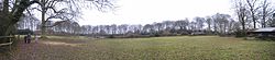
Interior of Cholesbury Camp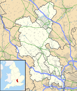
 Location within Buckinghamshire
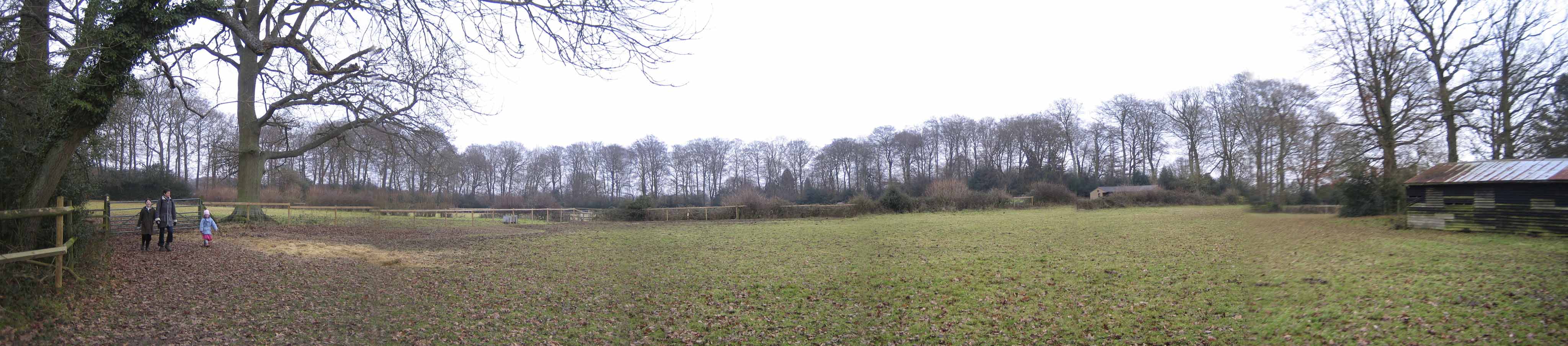
General information Architectural style Iron Age hill fort Town or city Cholesbury Country England Coordinates 51°45′22″N 0°39′14″W / 51.756062°N 0.653957°W Construction started 2nd century BC? Technical details Size 10 acres (4.0 ha) Cholesbury Camp is a large and well-preserved Iron Age hill fort on the northern edge of the village of Cholesbury in Buckinghamshire, England. It is roughly oval-shaped, covers an area of 10 acres (4.0 ha), and measures approximately 310 m (1,020 ft) north-east to south-west by 230 m (750 ft) north-west to south-east. The interior is a fairly level plateau and has been used as farmland since the medieval period.[1] The fort is now a scheduled ancient monument.[2]
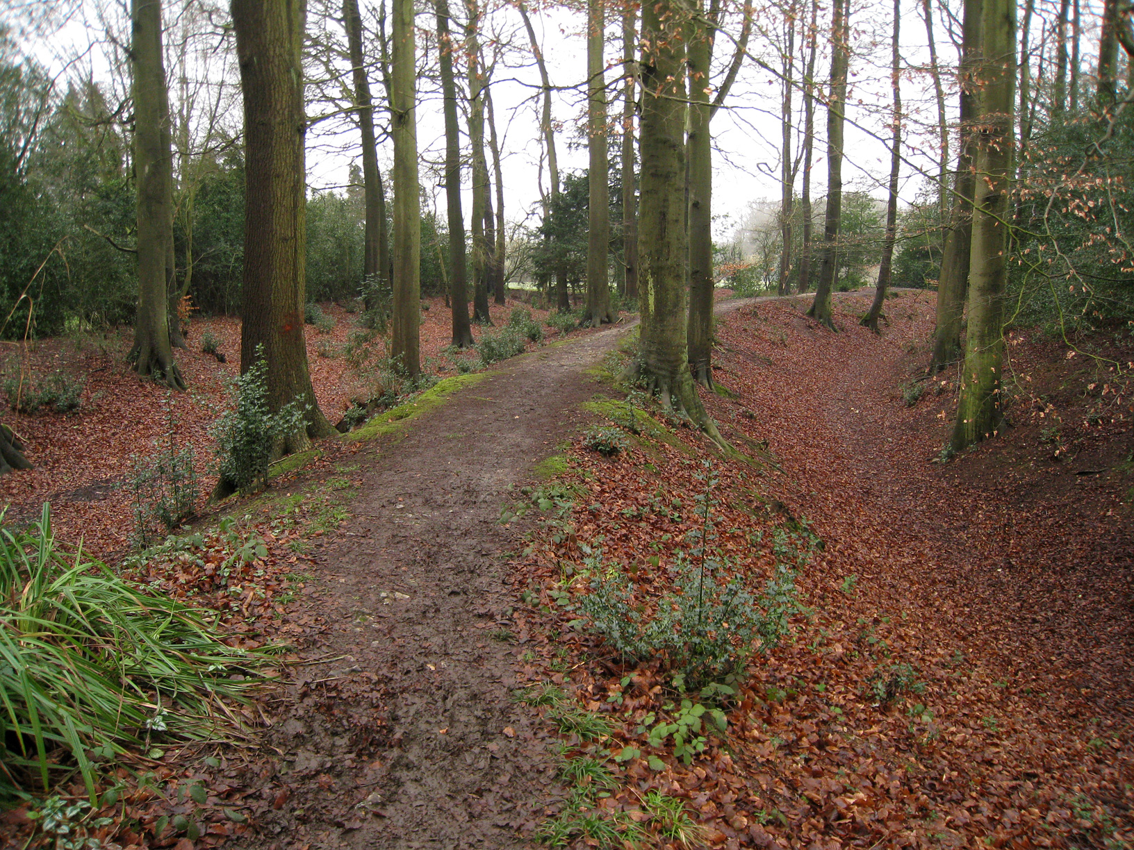
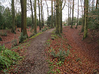 Western inner bank of Cholesbury Camp
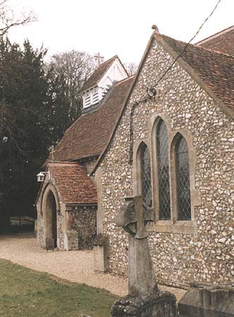
 St Lawrence Church, built within the ramparts of the fort
The fort is of the multivallate type, in other words having two or more lines of concentric earthworks. Most examples of such forts were built and used during the British Iron Age period between the 6th century BC and the Roman invasion of Britain in the 1st century AD.[1] The date of Cholesbury Camp's construction is unclear, but may lie in the 2nd century BC during the Middle Iron Age.[3] It was previously, though erroneously, attributed to the Danes and until the early 20th century was known locally as "The Danish Camp" and incorrectly recorded as such on maps. [1] It has also been suggested that it may have been constructed on the same site as an earlier, "Bronze Age" defensive structure.[4]
The fort is located in the Chiltern Hills at an altitude of over 190 m (620 ft). The porosity of the ground in the area severely limited the availability of surface water, essential for livestock, and therefore precluded year-round settlement adjacent to most of the upland pastures. However, close to the centre of the fort is a water source, called the Holy or Bury Pond. The constancy of this supply, over many hundreds of years, is cited as being crucial to the decision as to where to site the hill fort and for the early establishment of the isolated community at Cholesbury.[5]
The earthen ramparts of the fort are today largely overgrown with a double belt of mature beech trees, planted in the 19th century. Most of the ramparts still remain intact, though they have been removed along a large part of the southern side through building construction between the 16th and early 20th centuries. The ramparts consist principally of two banks (inner and outer) enclosing a large ditch. There are four entrances to the central enclosure, though only one is thought to be original.[1] The inner bank is on average 8 metres (26 ft) wide with a height that varies between 0.8 metres (2.6 ft) to 2 metres (6.6 ft). Its front slope is angled at about 35 degrees and the rear slope at 50 degrees. The broad, flat top of the bank does not appear to have been lined with timber or stonework.
The adjoining ditch ranges from 6 metres (20 ft) to 12 metres (39 ft) wide and 2.5 metres (8.2 ft) to 3 metres (9.8 ft) deep, in the shape of a steep-sided V with an inner slope of about 50 degrees. The outer bank is less distinct but is still visible on the northern side of the fort. Further banks and ditches extend the ramparts to the south-east and to the west, where they are particularly well-preserved for a distance of about 90 metres (300 ft).[2][6]
Excavations by Day Kimball in 1932[7] indicated that during the Iron Ages, Cholesbury Camp was only sparsely and possibly intermittently inhabited, presumably in times of strife when it provided a refuge or a defensive position. Well-preserved remains of prehistoric hearths or fire-sites and the remains of a clay-lined oven were found. Three of the hearths appear to have been used to smelt iron. Numerous fragments of pottery were found dating from the Middle Iron Age to the Late Iron Age (approximately 300BC-50AD).[1] The main period of occupation appears to have been around the middle of the 1st century BC.[2]
From the time of the Roman occupation in 54AD until the early medieval period the hill fort was probably deserted. The initial satellite settlement was originally associated with nearby Drayton Beauchamp and from which the present-day village of Cholesbury had been founded during the late Anglo-Saxon settlement. The first record of the settlement's name, as Chelwoldesbyr, was at the end of the 13th century. The name derives from the Anglo-Saxon Ceolweald's burh (i.e. the fortified place of Ceolweald's people).[8]
Today the Church of St Lawrence is located within the remains of the defences of the Iron Age fort, one of two such churches of the same name built within a hill fort in Buckinghamshire. Its location suggests that the fort still had some kind of politico-religious significance long after its original use had been forgotten.[9] The oldest parts of the present church date back to the 12-13th century, possibly replacing an earlier Anglo-Saxon wooden church. After falling into disrepair the church was partly rebuilt and restored in the 1870s in the Victorian style.[10] A geophysical survey carried out in the interior of the fort in July 2000[11] found evidence that the interior had been reoccupied in the medieval period, possibly by the construction of Cholesbury Manor House and an associated small settlement.[12]
References
- ^ a b c d e "Cholesbury Camp", information board at location. Chiltern Conservation Board, date unknown.
- ^ a b c Cholesbury Camp. Pastscape, English Heritage. Accessed 20 February 2011
- ^ Richard Cavendish, Prehistoric England, p. 92. British Heritage Press, 1983. ISBN 9780517417287
- ^ Branigan, Keith. (1967). "The distribution and development of Romano-British occupation in the Chess Valley". Records of Buckinghamshire 18: 136–49.
- ^ Hepple & Doggett, Leslie & Alison (1971). The Chilterns. England: Phillimore & Co Ltd. ISBN 0 85033 833 6.
- ^ Michael Avery, Hillfort Defences of Southern Britain. Volume II, Appendix A, p. 105. Tempus Reparatum, 1993. ISBN 9780860547549
- ^ Kimble G. D.(1933) Cholesbury Camp J. Brit. Arch. Assn. Vol 39(1) 187-212
- ^ Ekwall, Eilert (1977). The Concise Oxford Dictionary of English Place Names. Oxford, England: Oxford University Press. ISBN 019869103 3.
- ^ Michael Reed, The landscape of Britain: from the beginnings to 1914, p. 174. Routledge, 1997. ISBN 9780415157452
- ^ Cholesbury Parish British History Online, Retrieved 21-02-2011
- ^ Gover, J (2001). A Geophysical Survey of Cholesbury Camp Report Unpubl.
- ^ Cholesbury Camp. Buckinghamshire County Council. Accessed 20 February 2011
Categories:- 2nd-century BC architecture
- Archaeological sites in Buckinghamshire
- English Heritage sites in Buckinghamshire
- Hill forts in Buckinghamshire
- Scheduled Ancient Monuments in Buckinghamshire

Wikimedia Foundation. 2010.