- Chapoma
-
Chapoma (English)
Чапома (Russian)- Rural locality[1] -
Selo[1]
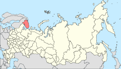
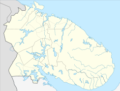
Location of Murmansk Oblast in RussiaCoordinates: 66°6′12″N 38°51′51″E / 66.10333°N 38.86417°ECoordinates: 66°6′12″N 38°51′51″E / 66.10333°N 38.86417°E Administrative status (as of 2010) Country Russia Federal subject Murmansk Oblast[1] Administrative district Tersky District[1] Statistics Population (2002 est.) 132 inhabitants[citation needed] Time zone MSD (UTC+04:00)[2] Postal code(s) 184716[3] Dialing code(s) +7 81559[4] Chapoma (Russian: Чапома) is the rural locality (a Selo) in Tersky District of Murmansk Oblast, Russia. The village is located on the Kola Peninsula. Located at a height of 1 m above sea level.
References
- ^ a b c d OKATO, Part 2. Code 47 220 000 004
- ^ Правительство Российской Федерации. Постановление №725 от 31 августа 2011 г. «О составе территорий, образующих каждую часовую зону, и порядке исчисления времени в часовых зонах, а также о признании утратившими силу отдельных Постановлений Правительства Российской Федерации». Вступил в силу по истечении 7 дней после дня официального опубликования. Опубликован: "Российская Газета", №197, 6 сентября 2011 г. (Government of the Russian Federation. Resolution #725 of August 31, 2011 On the Composition of the Territories Included into Each Time Zone and on the Procedures of Timekeeping in the Time Zones, as Well as on Abrogation of Several Resolutions of the Government of the Russian Federation. Effective as of after 7 days following the day of the official publication).
- ^ Russian Post. Эталонный справочник индексов объектов почтовой связи (Russian)
- ^ Народная энциклопедия городов и регионов России «Мой Город» (Russian)

This Murmansk Oblast location article is a stub. You can help Wikipedia by expanding it.

