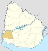
- Chacras de Dolores
-
Chacras de Dolores — Populated rural area — Location in Uruguay Coordinates: 33°33′0″S 58°13′0″W / 33.55°S 58.216667°WCoordinates: 33°33′0″S 58°13′0″W / 33.55°S 58.216667°W Country  Uruguay
Department Soriano Department Population (2004) - Total 3,251 Time zone UTC -3 Postal code 75100 Area code(s) +598 4534 Chacras de Dolores, which means "Ranches of Dolores", is a populated rural area almost entierly surrounding the city of Dolores in the Soriano Department of western Uruguay. Its northern limit is the river Río San Salvador.
Population
In 2004 it had a population of 3,251.[1]
Year Population 1996 2,337 2004 3,251 Source: Instituto Nacional de Estadística de Uruguay[2]
References
- ^ "2004 Census of Soriano department" (XLS). INE. 2004. http://www.ine.gub.uy/fase1new/Soriano/Cuadro7_17.XLS. Retrieved 27 June 2011.
- ^ "1963–1996 Statistics / C" (DOC). Instituto Nacional de Estadística de Uruguay. 2004. http://www.ine.gub.uy/biblioteca/toponimico/TOPOletraC.doc. Retrieved 27 June 2011.
External links
 Soriano Department of Uruguay
Capital: Mercedes Towns and
villagesCardona • Chacras de Dolores • Dolores • Egaña • José Enrique Rodó • Mercedes • Palmitas • Risso • Santa Catalina • Villa Darwin • Villa Soriano

Sights Agraciada Beach
Categories:- Uruguay geography stubs
- Populated places in the Soriano Department
Wikimedia Foundation. 2010.

