- Nueva Guinea
-
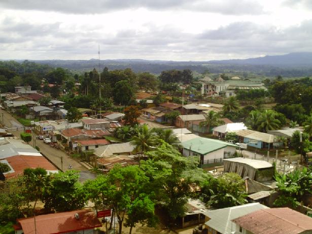
Nueva Guinea Preview of Nueva Guinea, RAAS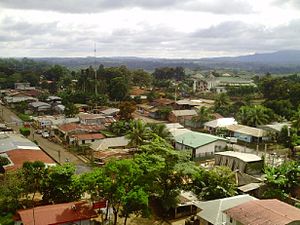
Seal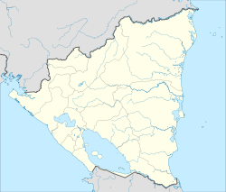
 Nueva Guinea
Coordinates: 11°41′N 84°27′W / 11.683°N 84.45°W Country  Nicaragua
Autonomous Region Autonomous Region of the Southern Atlantic Municipality Nueva Guinea Government - Mayor Denis Obando Marín Elevation 184 m (604 ft) Population (2005) - City 145,047 - Urban 66.936 Website Nueva Guinea Nueva Guinea is a municipality in the Región Autónoma del Atlántico Sur department of Nicaragua.
Nueva Guinea was founded in the 1960s and saw significant growth in the early 1970s as the US Peace Corps helped to move families from the Pacific region of Nicaragua to Nueva Guinea in exchange for free land and agricultural help.[citation needed] Today, the area is important in the nation's agricultural and livestock production.
Contents
Geography
The municipality borders to the north with the municipalities Bullocks Wharf and El Rama, south to San Carlos, El Castillo and Bluefields, on the east by the municipalities of El Rama and Bluefields and west with those of The Almond, Villa Sandino and San Miguelito.
The county seat is located 292 km from the city of Managua.
The town is divided about halfway through the mountains of the Cordillera de Yolaina.
Nature and Climate
The climate of the town is within the generic rainforest. The average annual rainfall of 2,245 millimeters.
The territory on which sits the town consists of Tertiary basaltic volcanic deposits, and on these rocks primarily an upper layer of red clay with thicknesses ranging between 50 and 60 feet in the subsequent layer is often gravel. All these soils have low fertility rates to media.
Towns
In New Guinea there is a unique system of territorial organization in the country: the administrative unit immediately to the city are the districts in which there are five not including the village and each district comprises a number of colonies ranging from two to twelve and the colonies are in turn subdivided into districts comarcas.3 states do are: Talolinga, Naciones Unidas, La Fonseca, La Union and Nueva Guinea.
Economy
The main economic activity is agriculture, particularly agriculture (quequisque, cassava, taro, bananas, tomatoes, rice, beans, corn, etc..), Since livestock is intended primarily for domestic consumption locally and nationally. The low productivity for agriculture of land won from the jungle a few years after plowing makes the peasants will continue leaving for pasture and forest clearing, which is calculated in a few decades could float away all the forests area.
Now it seems one of the most developed municipalities of Nicaragua, but this development is based on unsustainable agricultural activities and not suitable for the tropical wet forest vocation.
History
The territory has been inhabited since ancient times, in the Punta Gorda River basin remains have been discovered almost destroyed in a pre-Hispanic civilization edified concentric structures, and analysis of pottery collected by Smithsonian researchers date it to about 3000 to 4000 years before our era.
In the first half of the twentieth century began colonizing the area with the first clearing of jungle, being from 1950 when it began to populate the area for extractive activities such as rubber and wood raicilla
University
The area has Universities:
University of the Autonomous Regions of the Nicaraguan Caribbean Coast (URACCAN) URACCAN
University of the Assemblies of God, Martin Luther. (UML)
West University (UDO)
Agricultural Technical Education Center (CETA / INATEC).
References
↑ Census 2005 - National Institute of Statistics and Censuses, Nicaragua ↑ Nicaraguan Institute for Municipal Development ↑ Mayor of Nueva Guinea, Socioeconomic Municipality Population Census, December 1999.Coordinates: 11°41′N 84°27′W / 11.683°N 84.45°W
Capital: Bluefields Municipalities Bluefields · Bocana de Paiwas · Corn Island · Desembocadura de la Cruz de Río Grande · El Ayote · El Rama · El Tortugero · Kukra Hill · Laguna de Perlas · Muelle de los Bueyes · Nueva Guinea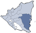 Categories:
- Populated places in Nicaragua
- Municipalities of Región Autónoma del Atlántico Sur
- Nicaragua geography stubs


Wikimedia Foundation. 2010.