- Phare du Portzic
Infobox Lighthouse
name = Phare du Portzic
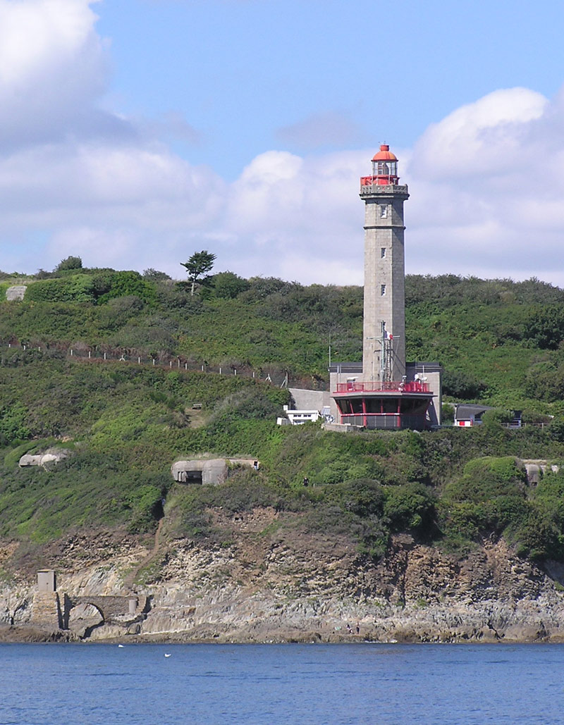
caption= The lighthouse in January 2006, from the sea
coordinates= Coord|48|21|30|N|4|32|03|W|scale:2000_region:FR_type:landmark|display=inline,title [WLOTA]
location= Goulet deBrest ,Finistère ,France
foundation=1848
height= 35 m
elevation= 56 m
range= 20 nautical miles
characteristic = To white sectors
2 occ., 10 s.
2 flashing directional lights
automated =1984 The phare du Portzic is situated on the north-eastern extremity of theGoulet de Brest (Finistère ,France ) and is the nearest lighthouse to the town ofBrest . It was inscribed as amonument historique before 1987 [ [http://www.culture.gouv.fr/public/mistral/merimee_fr?ACTION=RETROUVER&FIELD_98=LOCA&VALUE_98=%20Brest&NUMBER=7&GRP=0&REQ=%28%28Brest%29%20%3aLOCA%20%29&USRNAME=nobody&USRPWD=4%24%2534P&SPEC=1&SYN=1&IMLY=&MAX1=1&MAX2=100&MAX3=100&DOM=Tous Culture Ministry of France] ] . On the seaward side of the bottleneck entrance to the goulet, the lighthouse faces thePointe des Espagnols .It was built on military land in
1848 , at the same time as the phare du Petit Minou (started slightly earlier to the north of the Goulet. It was electrified in 1953 and automated in 1984 (though a semaphore post set up at its base in 1987 to regulate traffic in and out of the goulet is still permanently manned).Characteristics
*Signals : 1 main light for the sector with 2 flashes every 10 seconds (2 second flash then 6 second flash), accompanied by 2 twinkling directional lights in the direction of the Goulet, one continous (one flash per second, known as the North signal, indicates to a navigator that he finds himself to the north of the channel), the other with 6 short flashes (one per second) and a long flash, known as the South signal, indicating to the nvaigator that he finds himself to the south of the channel.
Notes
Wikimedia Foundation. 2010.