Elmira Heights Village Hall
- Elmira Heights Village Hall
Infobox_nrhp | name =Elmira Heights Village Hall
nrhp_type =
caption =
location= Elmira Heights, New York
lat_degrees = 42
lat_minutes = 7
lat_seconds = 46
lat_direction = N
long_degrees = 76
long_minutes = 49
long_seconds = 18
long_direction = W
locmapin = New York
area =
built =1896
architect= Pierce,J.H.; Bickford,H.H.
architecture= Late 19th And 20th Century Revivals, Other
added = May 06, 1982
governing_body = Local
refnum=82003349[cite web|url=http://www.nr.nps.gov/|title=National Register Information System|date=2008-04-15|work=National Register of Historic Places|publisher=National Park Service] ]
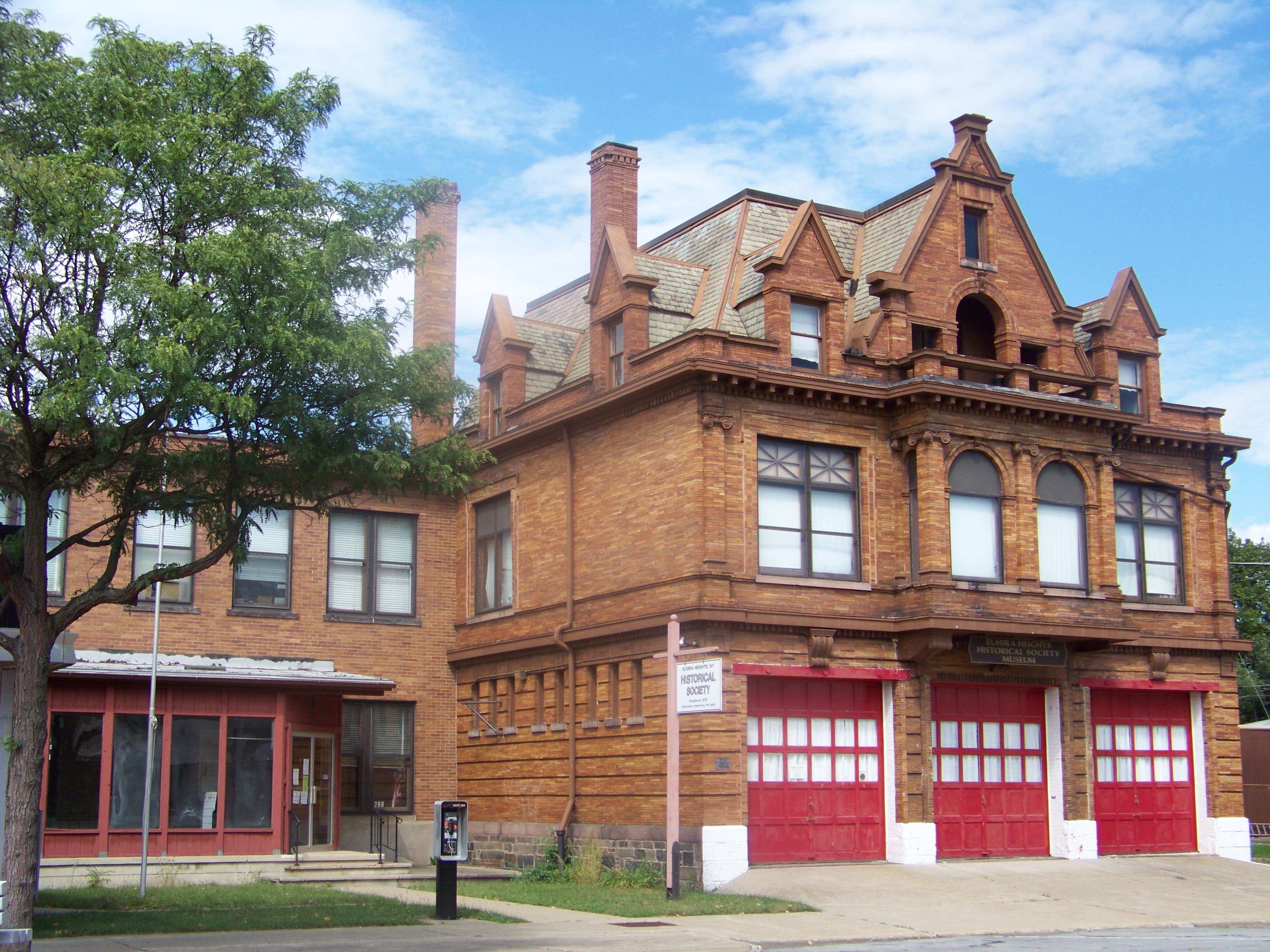
The Elmira Heights Village Hall was built in 1896. It was designed by local architects J. H. Pierce and H. H. Bickford. It is significant architecturally as an example of the Chateauesque or Northern Renaissance Revival style of the period. It is significant historically for its role in local government. The building was added to the National Register of Historic Places in 1982. [cite web|author=Lucy A. Breyer |title=National Register of Historic Places Inventory/Nomination:Elmira Heights Village Hall|url=http://www.oprhp.state.ny.us/hpimaging/hp_view.asp?GroupView=1120|date=July, 1980|accessdate=2008-09-27 and [http://www.oprhp.state.ny.us/hpimaging/hp_view.asp?GroupView=1119 "Accompanying 5 photos, from 1978"] ] ]References
Wikimedia Foundation.
2010.
Look at other dictionaries:
Elmira Heights, New York — Infobox Settlement official name = Elmira Heights, New York settlement type = Village nickname = motto = imagesize = image caption = image |pushpin pushpin label position = pushpin map caption =Location within the state of New York pushpin… … Wikipedia
National Register of Historic Places listings in Chemung County, New York — Location of Chemung County in New York … Wikipedia
Albany City Hall — U.S. National Register of Historic Places … Wikipedia
Menands, New York — Coordinates: 42°41′36″N 73°43′37″W / 42.69333°N 73.72694°W / 42.69333; 73.72694 … Wikipedia
List of FieldTurf installations — In 1999 the University of Nebraska Lincoln installed FieldTurf in Memorial Stadium. In 2006, Nebraska installed new FieldTurf that alternates between two shades of green every five yards. Texas Tech University installed FieldTurf in Jones AT T… … Wikipedia
Monroe (town), New York — Monroe town hall, on left next to village hall Monroe is a town in Orange County, New York, United States. The population was 31,407 at the 2000 census. The town is named after President James Monroe. The Town of Monroe contains three villages:… … Wikipedia
Tropical Storm Beryl (1994) — Infobox Hurricane Name=Tropical Storm Beryl Type=Tropical storm Year=1994 Basin=Atl Image location=Tropical Storm Beryl (1994).jpg Formed=August 14 Dissipated=August 19 1 min winds=50 Pressure=999 Da Inflated=0 Fatalities=1 Areas=Eastern Seaboard … Wikipedia
Colonie, New York — This article is about the town. For the village of the same name, see Colonie (village), New York. For the original municipality named Colonie, see Arbor Hill, Albany, New York. Coordinates: 42°43′43″N 73°47′4″W / … Wikipedia
Manhattan — New York Island redirects here. For the Pacific island, see Teraina. For other uses, see Manhattan (disambiguation). Manhattan Borough of New York City New York County … Wikipedia
List of places in the UTC-5 timezone — A# Abbeville, Alabama # Aberdeen, Maryland # Aberdeen, South Dakota # Abilene, Texas # Abingdon, Virginia # Abington Township, Mercer County, Illinois # Abington, Connecticut # Abington, Massachusetts # Abita Springs, Louisiana # Acton,… … Wikipedia