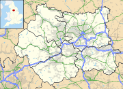
Moorside Edge transmitting station — Moorside Edge transmitting statio … Wikipedia
Edge — An edge in common usage denotes a sharp border of a (solid) object.cience and technology* Edge (graph theory), a line segment joining two nodes in a graph * Edge (geometry), a line segment joining two vertices in a polytope * Edge case, a problem … Wikipedia
Moorside Grange Hotel (Manchester) — Moorside Grange Hotel country: United Kingdom, city: Manchester (Out of the City / Stockport Higher Dis) Moorside Grange Hotel Hilton Moorside Grange, nestling on the edge of Lyme Park in the Peak District and only 25 minutes from Manchester city … International hotels
North West England — This article is about the government office region. For the European constituency, see North West England (European Parliament constituency). North West England North West region shown within England Geography Status Region … Wikipedia
Emley Moor transmitting station — Infobox UK Transmitter name = Emley Moor Clear skies over Emley Moor Tower height = convert|330.4|m|ft|0 gridref=SE222128 built = 1969 1971 demolished = collapsed = BBC = BBC Yorkshire ITV = ITV YorkshireLocation map|West Yorkshire label = lat =… … Wikipedia
Holme Moss — Location map West Yorkshire lat=53.5333 long= 1.858056 width=180 float=right caption= Holme Moss moor shown within West Yorkshire (gbmapping|SE095040)Holme Moss is a moor in the south Pennines of England, on the border between the High Peak… … Wikipedia
Droitwich transmitting station — Masts at Droitwich transmitting station The Droitwich transmitting station is a large broadcasting facility for longwave and mediumwave transmissions, established in 1934 in the civil parish of Dodderhill, just outside the village of Wychbold,… … Wikipedia
Arqiva — Type Private Industry Telecommunications Founded 2005 Headquarters … Wikipedia
Scapegoat Hill — Infobox UK place country = England official name= Scapegoat Hill map type= West Yorkshire latitude = 53.644307 longitude = 1.867756 population=1,246 metropolitan borough= Kirklees metropolitan county= West Yorkshire region = Yorkshire and the… … Wikipedia
L. Rome Guthrie — Leonard Rome Guthrie (1880 1958) was an architect. [ [http://www.york.ac.uk/depts/arch/landscapes/ukpg/designer/guthriel.htm U.K. Database of Historic Parks and Gardens: Guthrie, Leonard Rome] (retrieved 11 April 2007)] Works His works included:… … Wikipedia

