- Voordorp
Infobox Settlement
name =Voordorp
official_name =
other_name =
native_name =
nickname =
settlement_type =
total_type =
motto =
imagesize =
image_caption =
flag_size =
image_
seal_size =
image_shield =
shield_size =
image_blank_emblem =
blank_emblem_type =
blank_emblem_size =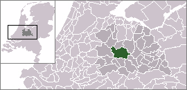
mapsize =
map_caption =
mapsize1 =
map_caption1 =
image_dot_
dot_mapsize =
dot_map_caption =
dot_x = |dot_y =
pushpin_
pushpin_label_position =
pushpin_map_caption =Location within the Netherlands
pushpin_mapsize =
subdivision_type = Country
subdivision_name = Kingdom of the Netherlands
subdivision_type1 = Constituent country
subdivision_name1 = NLD
subdivision_type2 = Province
subdivision_name2 = Utrecht
subdivision_type3 =
subdivision_name3 =
seat_type =
seat =
parts_type =
parts_style =
parts =
p1 =
p2 =
government_footnotes =
government_type =
leader_title =Mayor
leader_name =
leader_title1 =
leader_name1 =
established_title =
established_date =
area_magnitude =
unit_pref =
area_footnotes =
area_total_km2 =1.9
area_land_km2 =1.5
area_water_km2 =0.4
area_total_sq_mi =
area_land_sq_mi =
area_water_sq_mi =
area_water_percent =
elevation_footnotes =
elevation_m =
elevation_ft =
elevation_max_m =
elevation_max_ft =
elevation_min_m =
elevation_min_ft =
population_as_of =2006
population_footnotes =
population_note =
population_total =3000
population_density_km2 =1578
population_density_sq_mi =
timezone = CET
utc_offset = +1
timezone_DST = CEST
utc_offset_DST = +2
coor_type =
latd=52 |latm=6 |lats= |latNS=N
longd=5 |longm=9 |longs= |longEW=E
postal_code_type =
postal_code =
area_code =
website = [http://www.voordorpvooruit.nl/ www.voordorpvooruit.nl/]
blank_name =
blank_info =
blank1_name =
blank1_info =
footnotes =Voordorp is a
district in the North East of the city of Utrecht, theNetherlands . It has a population of approximately 3,000 citizens.History
Voordorp was named after an old church village, Voordorp, which changed its name to Blaue Capel (meaning 'blue chapel') after the local
church was rebuilt and decorated in blue in1451 . It was built in the 90s as part of the last big expansion of Utrecht within the original city limits.Facilities
The convert|1.9|km2|sqmi|1|abbr=on area of Voordorp contains a
primary school , asnack bar , acafe , a skate slope, a nursery and a cattle market. There are plans to move the cattle market to Leidsche Rijn in order accommodate expansion of the district. It borders highway A27 which is situated behind anoise barrier .Location
From the heart of Utrecht it's a twenty minute bike ride or a twelve minute drive to Voordorp. With the line 5
bus riding through Voordorp it is possible to reach central Utrecht. Its streets are named afterfreedom fighters .Innovation
Recently, Voordorp was one of the first districts to get a
fibreglass connection. This connection is used for internet, television and telephone.References
* [http://home.wanadoo.nl/leokoenen/voordorp.htm Informative site about Voordorp]
External links
* [http://www.voordorpvooruit.nl/ Voordorp Vooruit] (Community website)

Wikimedia Foundation. 2010.